|
|
|

|
Morning newsletter
|
|
|
|
|
|
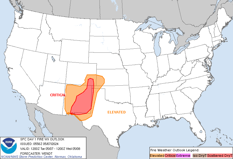
SPC Day 1 Fire Weather Outlook
|
|
|
|
SPC Day 1 Fire Weather Outlook Day 1 Fire Weather Outlook NWS Storm Prediction Center Norman OK 0124 AM CST Tue Feb 06 2024 Valid 061200Z - 071200Z ...NO CRITICAL AREAS... ...Synopsis... An upper ridge will overspread the central and eastern CONUS today as a mid-level trough impinges on the Rocky Mountains. Rain and snow accompanying the mid-level trough will …
|
|
|
|
|
|
|
|
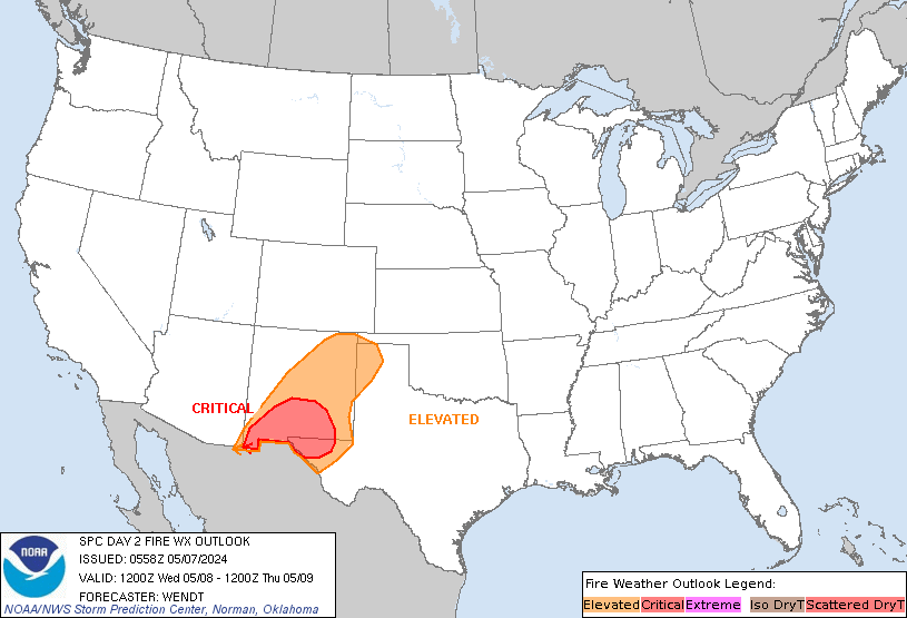
SPC Day 2 Fire Weather Outlook
|
|
|
|
SPC Day 2 Fire Weather Outlook Day 2 Fire Weather Outlook NWS Storm Prediction Center Norman OK 0124 AM CST Tue Feb 06 2024 Valid 071200Z - 081200Z ...NO CRITICAL AREAS... ...Synopsis... An upper ridge will progress toward the East Coast as a pronounced mid-level trough ejects into the Plains states tomorrow/Wednesday. Surface high pressure and associated dry air (i.e. …
|
|
|
|
|
|
|
|
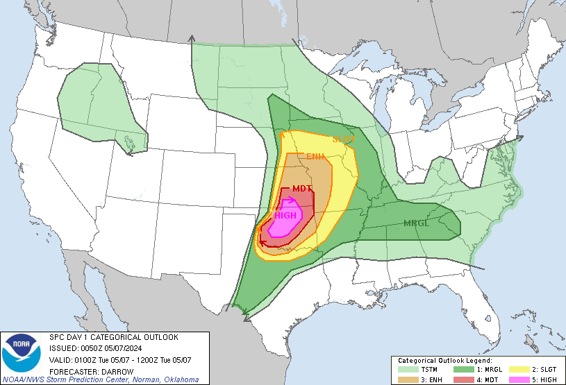
SPC Feb 6, 2024 0600 UTC Day 1 Convective Outlook
|
|
|
|
SPC 1200Z Day 1 Outlook Day 1 Convective Outlook NWS Storm Prediction Center Norman OK 1115 PM CST Mon Feb 05 2024 Valid 061200Z - 071200Z ...NO SEVERE THUNDERSTORM AREAS FORECAST... ...SUMMARY... The risk for severe thunderstorms appears negligible across the U.S., today through tonight. ...Synopsis... Mid/upper flow across the southern mid-latitude and subtropical eastern Pacific into western Atlantic is …
|
|
|
|
|
|
|
|
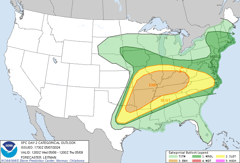
SPC Feb 6, 2024 0700 UTC Day 2 Convective Outlook
|
|
|
|
SPC 0700Z Day 2 Outlook Day 2 Convective Outlook NWS Storm Prediction Center Norman OK 1153 PM CST Mon Feb 05 2024 Valid 071200Z - 081200Z ...NO SEVERE THUNDERSTORM AREAS FORECAST... ...SUMMARY... Severe thunderstorms are not forecast on Wednesday. ...Synopsis... A large upper trough will remain over the West on Wednesday, with an intense shortwave moving from northern Mexico into …
|
|
|
|
|
|
|
|
SPC Feb 6, 2024 0830 UTC Day 3 Severe Thunderstorm Outlook
|
|
|
|
SPC 0830Z Day 3 Outlook Day 3 Convective Outlook NWS Storm Prediction Center Norman OK 0152 AM CST Tue Feb 06 2024 Valid 081200Z - 091200Z ...NO SEVERE THUNDERSTORM AREAS FORECAST... ...SUMMARY... A few general thunderstorms may occur over the upper Mississippi Valley on Thursday. Severe weather is unlikely. ...Synopsis... On Thursday, a large upper trough will affect much of …
|
|
|
|
|
|
|
|
SPC Day 3-8 Fire Weather Outlook
|
|
|
|
SPC Day 3-8 Fire Weather Outlook Day 3-8 Fire Weather Outlook NWS Storm Prediction Center Norman OK 0347 PM CST Mon Feb 05 2024 Valid 071200Z - 131200Z A deep western US trough will gradually move eastward over the central US through mid to late week this week. Strong mid-level flow will also persist over the southern and central US. …
|
|
|
|
|
|
|
|
SPC Feb 6, 2024 0100 UTC Day 1 Convective Outlook
|
|
|
|
SPC 0100Z Day 1 Outlook Day 1 Convective Outlook NWS Storm Prediction Center Norman OK 0649 PM CST Mon Feb 05 2024 Valid 060100Z - 061200Z ...NO SEVERE THUNDERSTORM AREAS FORECAST... ...SUMMARY... The risk for severe thunderstorms appears negligible across the U.S. through tonight. ...01Z Update... ...Florida... Weak thunderstorm activity may persist another hour or two inland of coastal areas, …
|
|
|
|
|
|
|
|
|
|