|
|
|
|
Evening newsletter
|
|
|
|
|
|
Overnight and Tomorrows forecast 2-8/9
|
|
Tonight - Overcast, windy, Low 47°F. Wind SSW at 15 to 25 mph. Tomorrow 2/9 - Overcast, windy, High 61°F. Wind SSW at 15 to 25 mph. Tomorrow night - Showers, Low 50°F. Wind SSW at 5 to 15 mph. 40% chance.
|
|
|
|
|
|
|
|
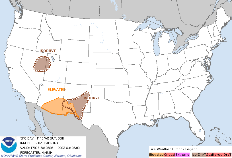
SPC Day 1 Fire Weather Outlook
|
|
|
|
SPC Day 1 Fire Weather Outlook Day 1 Fire Weather Outlook NWS Storm Prediction Center Norman OK 1039 AM CST Thu Feb 08 2024 Valid 081700Z - 091200Z ...NO CRITICAL AREAS... ...17z Update... Morning observations show wind gusts of 25-30+ mph and pockets of lower humidity becoming more numerous across the southern Plains. Winds should continue to increase through the …
|
|
|
|
|
|
|
|
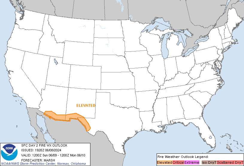
SPC Day 2 Fire Weather Outlook
|
|
|
|
SPC Day 2 Fire Weather Outlook Day 2 Fire Weather Outlook NWS Storm Prediction Center Norman OK 0114 PM CST Thu Feb 08 2024 Valid 091200Z - 101200Z ...NO CRITICAL AREAS... No changes, widespread critical fire-weather conditions appear low due to unfavorable fuels. Locally elevated to near-critical meteorological conditions will remain possible over parts of the southern Plains. See the …
|
|
|
|
|
|
|
|
SPC Feb 8, 2024 1630 UTC Day 1 Convective Outlook
|
|
|
|
SPC 1630Z Day 1 Outlook Day 1 Convective Outlook NWS Storm Prediction Center Norman OK 1030 AM CST Thu Feb 08 2024 Valid 081630Z - 091200Z ...THERE IS A MARGINAL RISK OF SEVERE THUNDERSTORMS FROM FAR EASTERN IOWA EASTWARD TO SOUTHWESTERN PARTS OF LAKE MICHIGAN... ...SUMMARY... A few strong/severe thunderstorms remain possible this afternoon through early evening across parts of …
|
|
|
|
|
|
|
|
SPC Feb 8, 2024 1730 UTC Day 2 Convective Outlook
|
|
|
|
SPC 1730Z Day 2 Outlook Day 2 Convective Outlook NWS Storm Prediction Center Norman OK 1128 AM CST Thu Feb 08 2024 Valid 091200Z - 101200Z ...NO SEVERE THUNDERSTORM AREAS FORECAST... ...SUMMARY... Severe potential currently appears rather uncertain Friday into Friday night, but trends will be closely monitored from parts of eastern Oklahoma through the mid Mississippi Valley and lower …
|
|
|
|
|
|
|
|
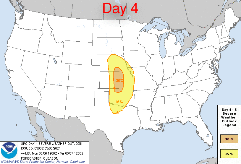
SPC Feb 8, 2024 Day 4-8 Severe Weather Outlook
|
|
|
|
Day 4-8 Outlook Day 4-8 Convective Outlook NWS Storm Prediction Center Norman OK 0355 AM CST Thu Feb 08 2024 Valid 111200Z - 161200Z ...DISCUSSION... Models are in good enough agreement for Sunday/D4, depicting a progressive shortwave trough moving from the southern Plains into the lower MS Valley. This system will maintain a positive-tilt overall, but is forecast to deepen. …
|
|
|
|
|
|
|
|
SPC Feb 8, 2024 0700 UTC Day 2 Convective Outlook
|
|
|
|
SPC 0700Z Day 2 Outlook Day 2 Convective Outlook NWS Storm Prediction Center Norman OK 1241 AM CST Thu Feb 08 2024 Valid 091200Z - 101200Z ...NO SEVERE THUNDERSTORM AREAS FORECAST... ...SUMMARY... Severe weather is not forecast on Friday. Scattered thunderstorms are most likely late in the day and overnight from central Texas through the Ohio Valley. ...Synopsis and Discussion... …
|
|
|
|
|
|
|
|
|
|