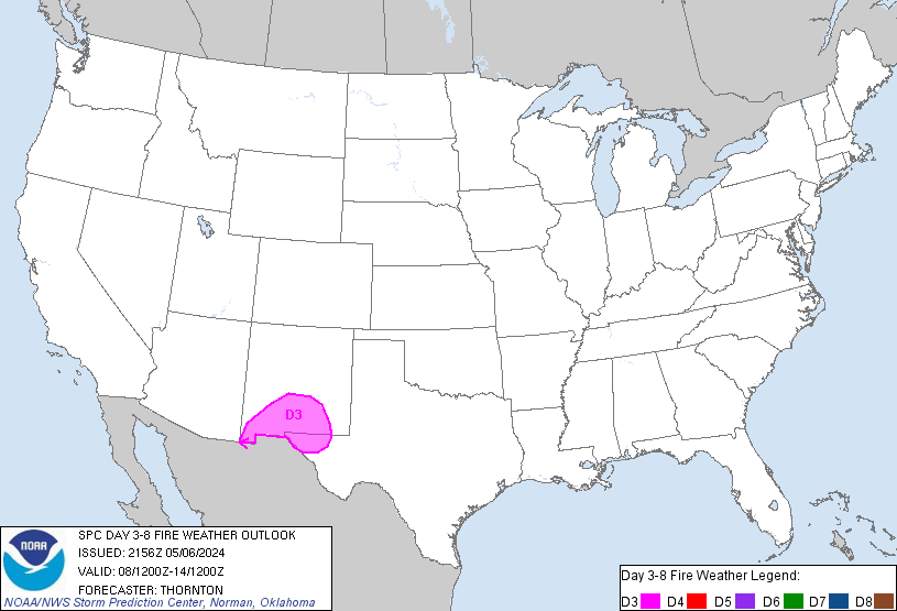
SPC Day 3-8 Fire Weather Outlook
Day 3-8 Fire Weather Outlook
NWS Storm Prediction Center Norman OK
0411 PM CDT Mon Apr 29 2024

Valid 011200Z - 071200Z

Mid-level flow will amplify across the western CONUS Wednesday and
Thursday as a mid-level jet streak moves into the Inter Mountain
West. As this occurs, lee cyclogenesis is expected which will make
dry and breezy conditions likely across portions of the Southwest
and southern High Plains Wednesday and Thursday. Beyond Thursday a
broad trough is expected in the western CONUS but stronger mid-level
flow and breezier conditions are not anticipated near dry fuels
across the Southwest and southern High Plains until the early part
of next week. However, there is considerable uncertainty in model
guidance by that time which precludes any probabilities.

...Day3/Wednesday - D4/Thursday - southern High Plains...
Dry and breezy conditions are expected across the Southwest and
southern High Plains on Wednesday and Thursday in response to the
developing lee cyclone, with additional support from the increasing
mid-level flow over a deeply mixed airmass. Single digit relative
humidity is likely both days. The strongest winds (20 to 25 mph
sustained), is likely on Wednesday. In addition, most of this area
has seen little to no precipitation over the past 2 weeks with
additional drying expected on Tuesday. Therefore, Critical fire
weather conditions are likely on Wednesday and Thursday.

..Bentley.. 04/29/2024

...Please see www.spc.noaa.gov/fire for graphic product...