SPC Day 1 Fire Weather Outlook
2024-04-27
SPC Day 1 Fire Weather Outlook
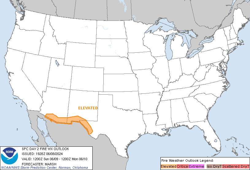
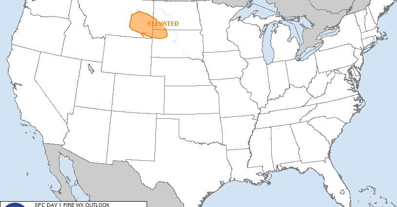
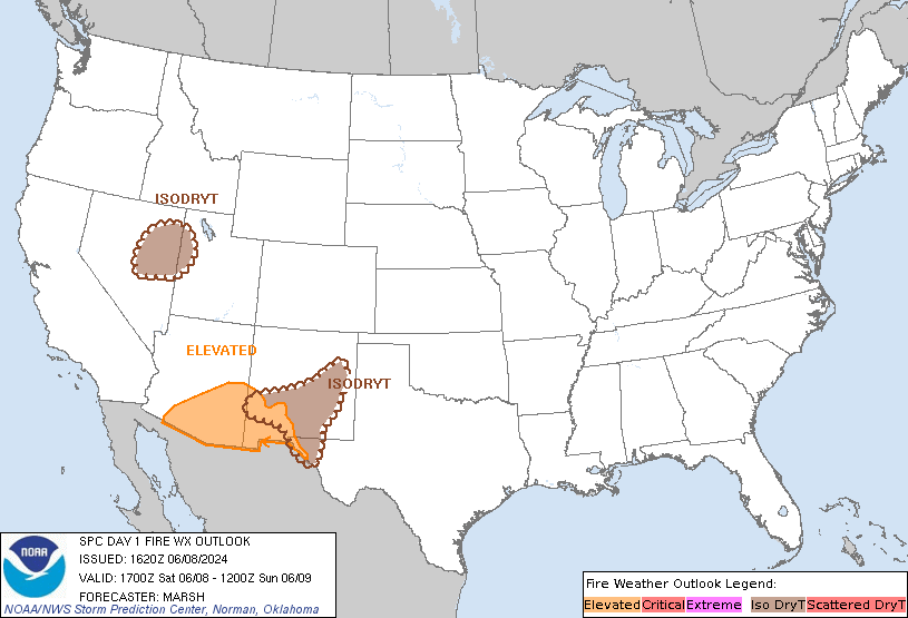
Day 1 Fire Weather Outlook
NWS Storm Prediction Center Norman OK
1056 AM CDT Sat Apr 27 2024

Valid 271700Z - 281200Z

...CRITICAL FIRE WEATHER AREA FOR PORTIONS OF THE SOUTHERN HIGH
PLAINS...

The previous forecast remains on track, with some trimming of the
fire weather highlights made where clouds and/or low-level moisture
is expected to persist through the day. Clear skies are present
behind the dryline, which is currently located over the eastern
Texas Panhandle. RH is already dropping into the 15-25 percent range
as the boundary layer mixes. With further daytime heating, surface
RH should drop into the 10-20 percent range as westerly sustained
surface winds approach 20+ mph, warranting the continuation of
Critical highlights over portions of the southern High Plains.

..Squitieri.. 04/27/2024

.PREV DISCUSSION... /ISSUED 0158 AM CDT Sat Apr 27 2024/

...Synopsis...
A strong mid-level jet streak will round the base of the western
trough today, with strong lee cyclogenesis resulting across the High
Plains. Strengthening flow amid very dry conditions will lead to
Elevated to Critical fire weather concerns across portions of the
southern High Plains into the central High Plains.

...Southern and Central High Plains...
A deeply mixed air mass is expected to be in be in place by this
afternoon across portions of eastern New Mexico into and eastward
into the Oklahoma/Texas Panhandles into southwestern Kansas. In
these regions, sustained surface winds 20-30 mph will overlap
afternoon relative humidity reductions to around 5-10 percent. The
Critical area was expanded further into southwestern Kansas, given
recent trends. While some spotty Extremely Critical conditions are
possible, fuels do not yet support inclusion of an Extremely
Critical area at this time.

...Please see www.spc.noaa.gov/fire for graphic product...