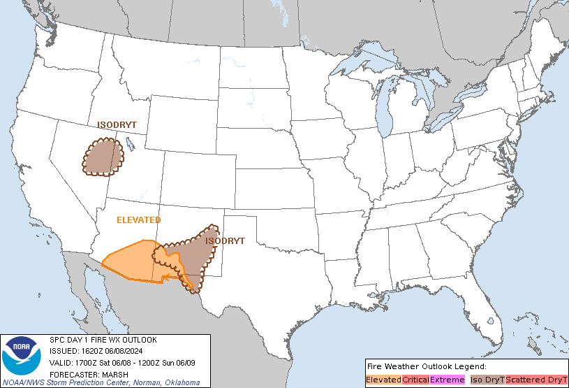
SPC Day 1 Fire Weather Outlook
Day 1 Fire Weather Outlook
NWS Storm Prediction Center Norman OK
1123 AM CDT Tue Apr 30 2024

Valid 301700Z - 011200Z

Trimmed the northeast portion of the Elevated area based on forecast
frontal position today. Otherwise, the forecast remains on track.
See previous discussion below.

..Bentley.. 04/30/2024

.PREV DISCUSSION... /ISSUED 0110 AM CDT Tue Apr 30 2024/

...Synopsis...
A belt of enhanced mid-level flow will spread across the Northern
Rockies from an upper low across the northwestern US today. A
cold frontal passage will bring rainfall across much of eastern
Montana and Wyoming this morning. Behind the cold front, a dry
continental air mass will overspread this region into the western
Dakotas, with relative humidity dropping as low as 15 percent amid
sustained winds 20-25 mph. Fuels within southern Montana into the
western Dakotas, where less rainfall is forecast, are sufficiently
dry to carry risk of Elevated fire weather concerns.

...Please see www.spc.noaa.gov/fire for graphic product...