Knowledge database
High Wind Event – February 24, 2019
High Wind Event – February 24, 2019
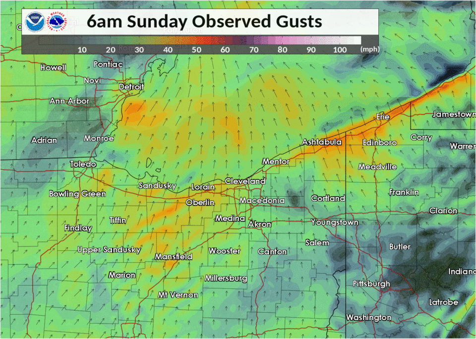
A long duration high wind event occurred across the area on Sunday February 24, 2019. A cold front moving west to east brought very strong southwest to westerly winds to the region during the morning hours. Strong winds behind the cold front began in Northwest Ohio around 8 AM, reached the greater Cleveland area after 9 AM, and then Northwest Pennsylvania by noon. Wind gusts of 50-60 mph were common through the afternoon and into the evening with some locations experiencing gusts of over 60 mph. Some of the peak wind reports included 67 mph in Cleveland, 67 mph in Elyria, 64 mph in Toledo, 63 mph in Findlay, and 61 mph at both Akron-Canton, and Youngstown.
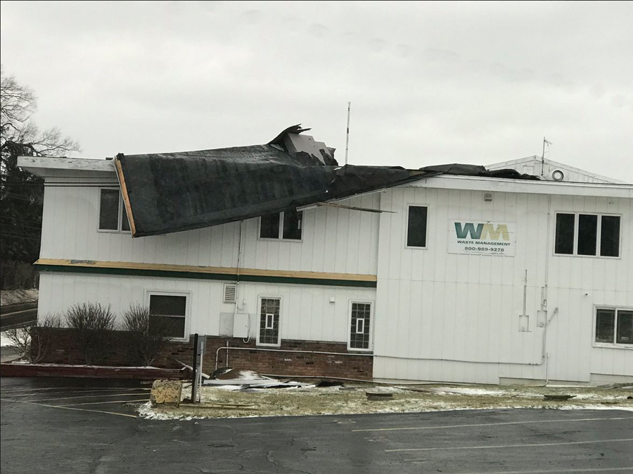
The persistent battering of the very strong winds resulted in thousands of power outages to residents across the area. Early estimates include over 200,000 outages across Ohio and over 100,000 in Pennsylvania. Damage to trees were common, as large limbs were snapped or whole trees uprooted, exasperated by wet soil conditions that allowed trees to be toppled easily. In some cases trees fell on homes, power wires, and other structures. At least 2 semi-trucks were flipped on area roadways and a ban on empty semi-trucks was issued prior to the onset of strong winds for the Ohio Turnpike and I-90 in Pennsylvania by the Ohio and Pennsylvania Departments of Transportation. Structural damage from the wind has also been reported to numerous structures. If you’re interested in a list of the damage reports reported to the National Weather Service, please click here for an interactive map. The full list can also be viewed at the bottom of the article.
Below is a map of the observed wind gusts starting 6 AM Sunday and ending 3 AM Monday. Notice the onset of the red and orange colors around 9-10 AM, coincident with a line of showers associated with the main cold front pushing through the region.
Meteorology
Strong winds impacting the region were a result of a rapidly deepening low pressure system that tracked out of the southern Plains towards the Great Lakes Region. Low pressure originated over the panhandle of Texas on Saturday with central pressure of 998mb. The low tracked northeast to near Chicago by Midnight Saturday night, lifting a warm front across northern Ohio. Temperatures warmed through the overnight hours and were in the mid to upper 50s by Sunday morning. The low continued northeast towards eastern portions of the Upper Peninsula of Michigan on Sunday morning, deepening to 974mb. The system underwent an occlusion process with both the occluded front followed by a strong cold front moving east across the area on Sunday morning. This system contained a very strong wind field with speeds of 60 knots near 4000 feet and over 100 knots with the upper level jet. As the cold front swept east across the area, an abrupt increase in downward momentum brought the first push of strong winds to the area. Temperatures fell approximately 20 degrees in only four hours. Damaging wind gusts continued through the afternoon and into the evening as cold advection contributed to a deepening boundary layer which allowed for strong wind gusts to frequently mix down to the surface.The low continued to move away from the area Sunday night, which allowed the winds to finally let up by Monday morning.
| Surface Analysis Maps |
| 7 PM Saturday |
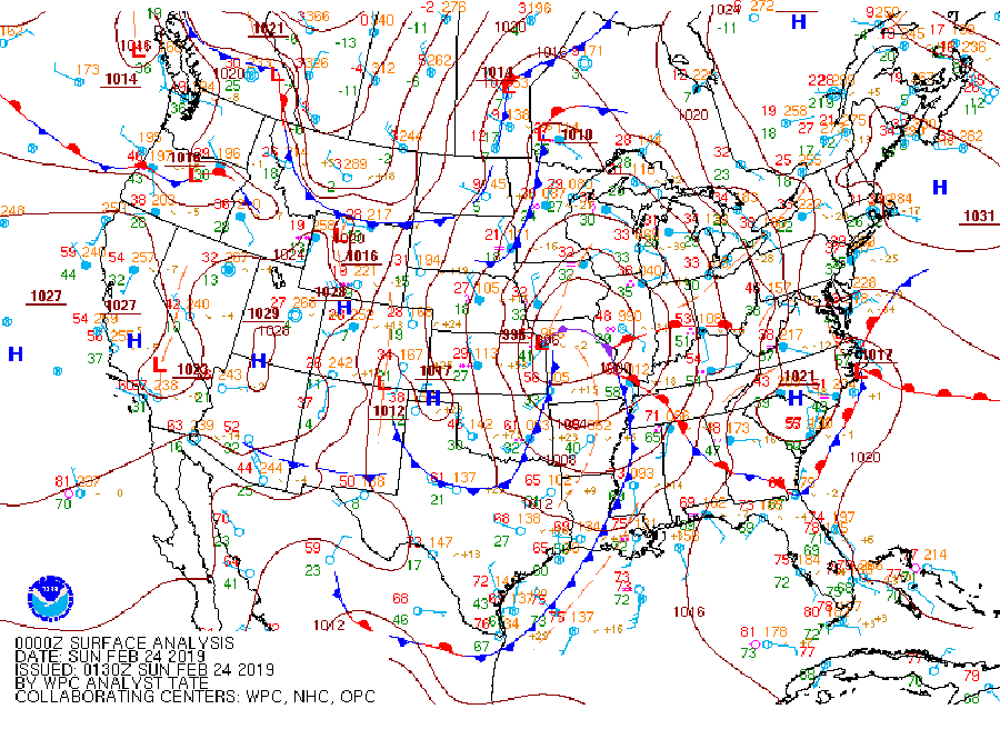 |
| 7 AM Sunday |
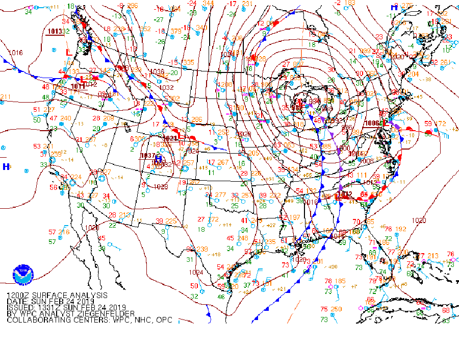 |
| 7 PM Sunday |
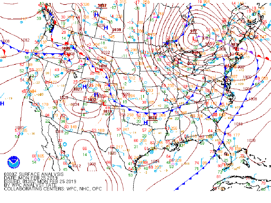 |
Click for a larger image
| Pictures of Wind Damage | |
 |
 |
| Ravenna, Ohio | Elyria, Ohio |
|
|
|
 |
 |
| Bradner, Ohio | Bradner, Ohio |
|
|
|
 |
 |
| Akron, Ohio | Akron, Ohio |
|
|
|
 |
 |
| Richfield Township, Ohio | Broadview Heights, Ohio |
|
|
|
 |
 |
| Tiffin, Ohio | Broadview Heights, Ohio |
|
|
|
 |
 |
| North Canton, Ohio | Geauga County, OH |