Knowledge database
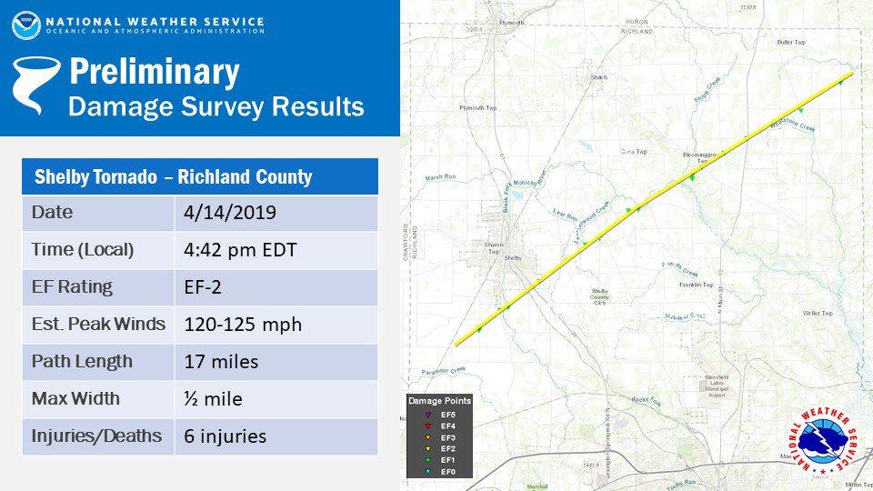
Shelby, Ohio Tornado – April 14 2019
According to the NWS, the tornado first touched down around 4:42 p.m. three miles southwest of Shelby, and it ended at around 5 p.m. about five miles north of Olivesburg.
Radar loop of Shelby Tornado
(upper left: 0.5 Reflectivitiy -Z, upper right: 0.5 Storm Relative Velocity – SRM, lower right: 0.5 Differential Reflectivity – ZDR, lower left: 0.5 Correlation Coefficient – CC)
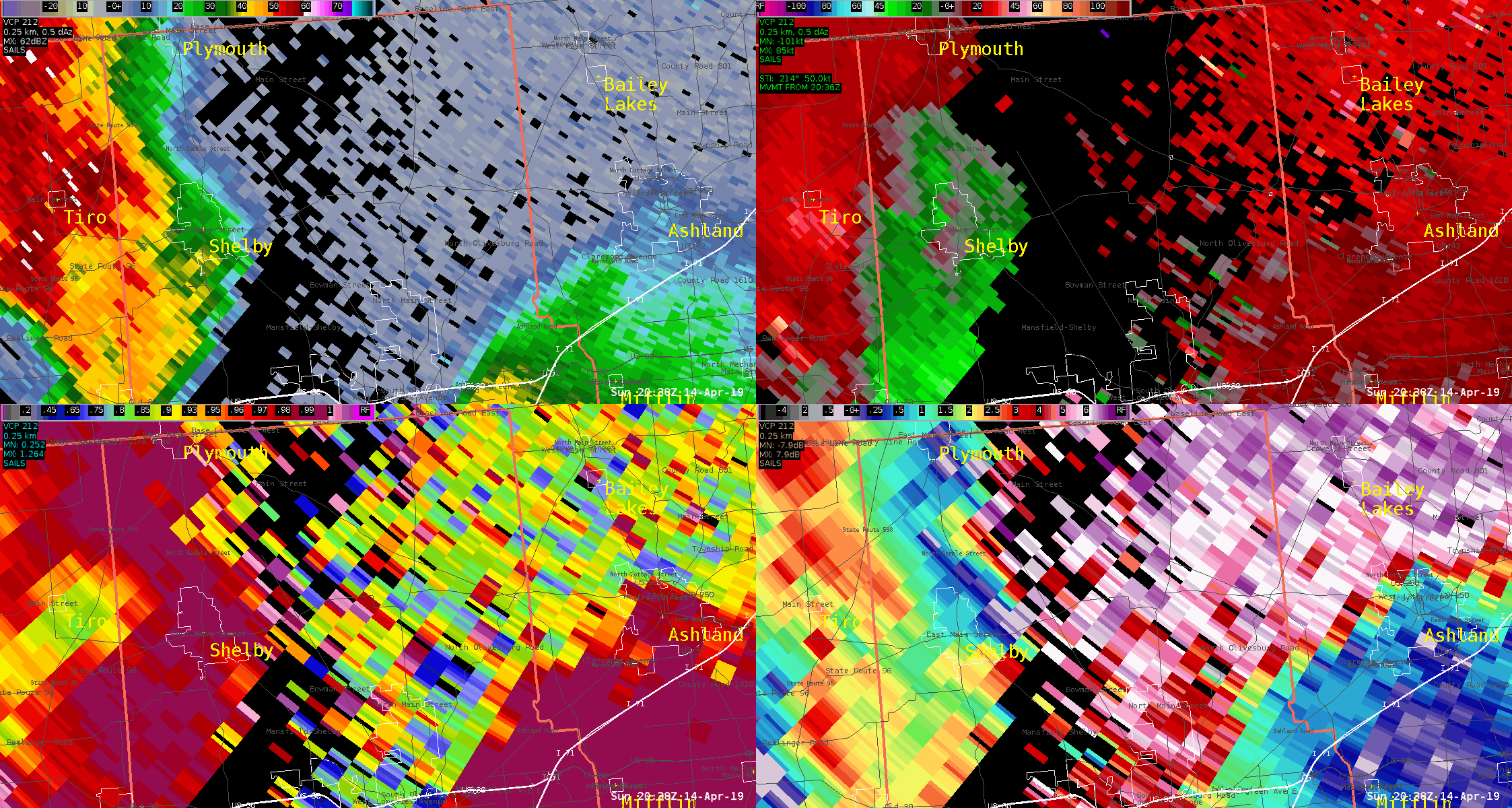
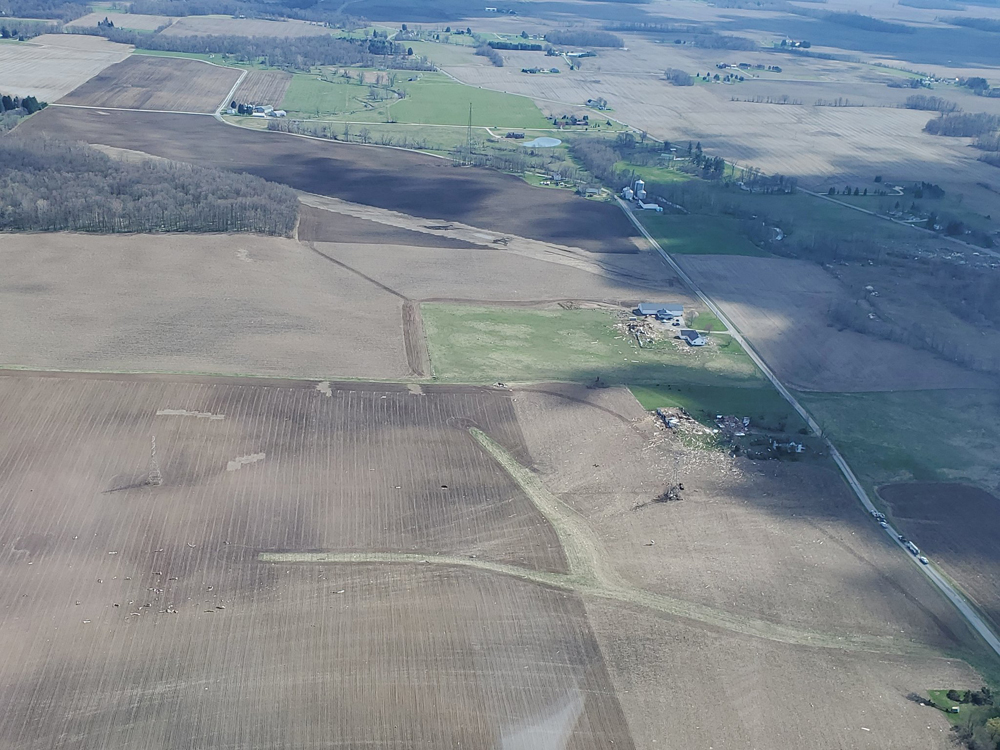
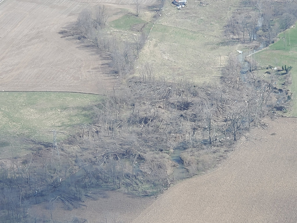
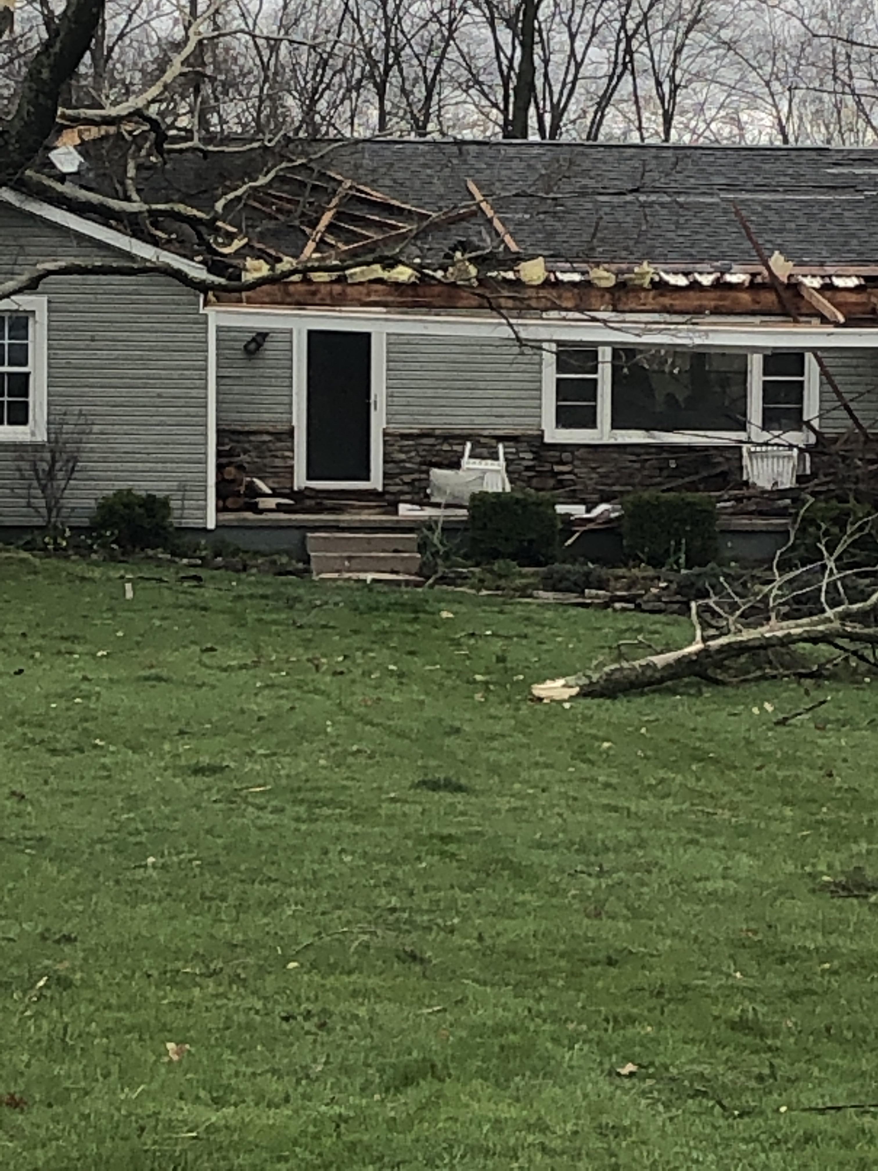
Estimated maximum wind speed was between 120 and 125 miles per hour. The maximum width of the tornado was 1/2 mile, and the length of the path was 17 miles.
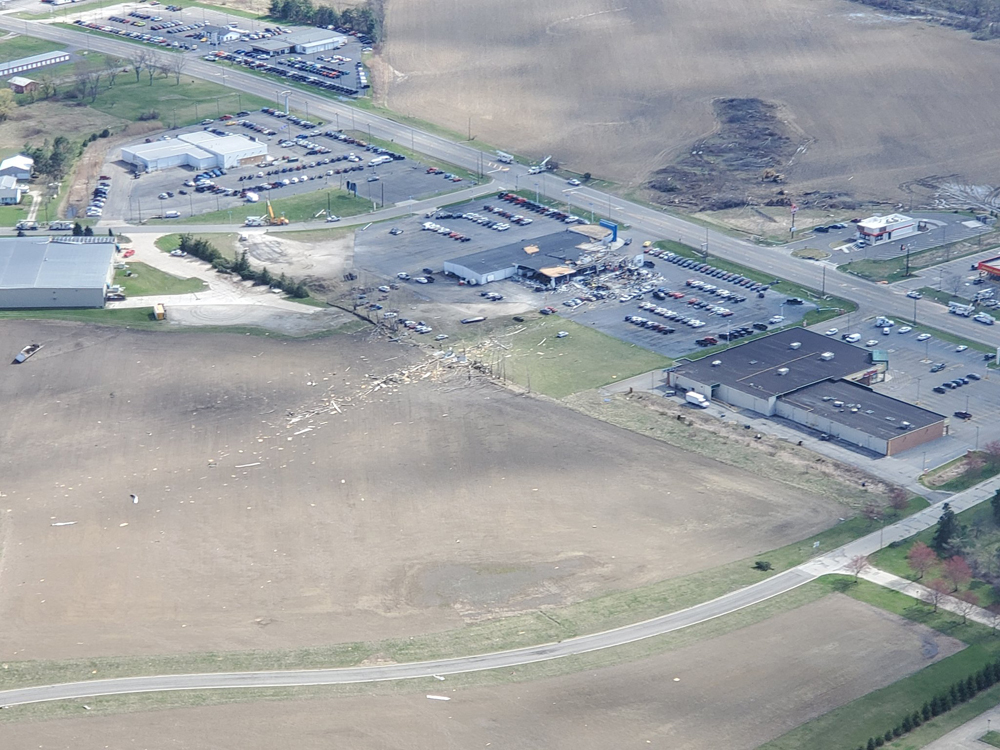
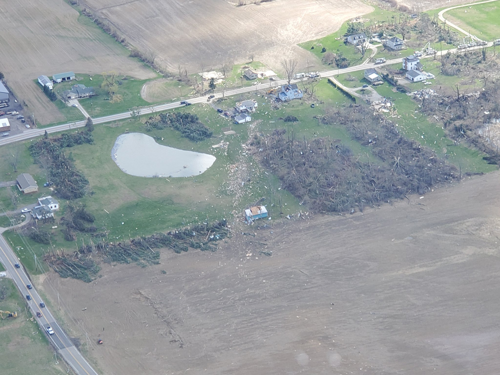
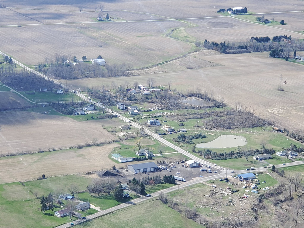
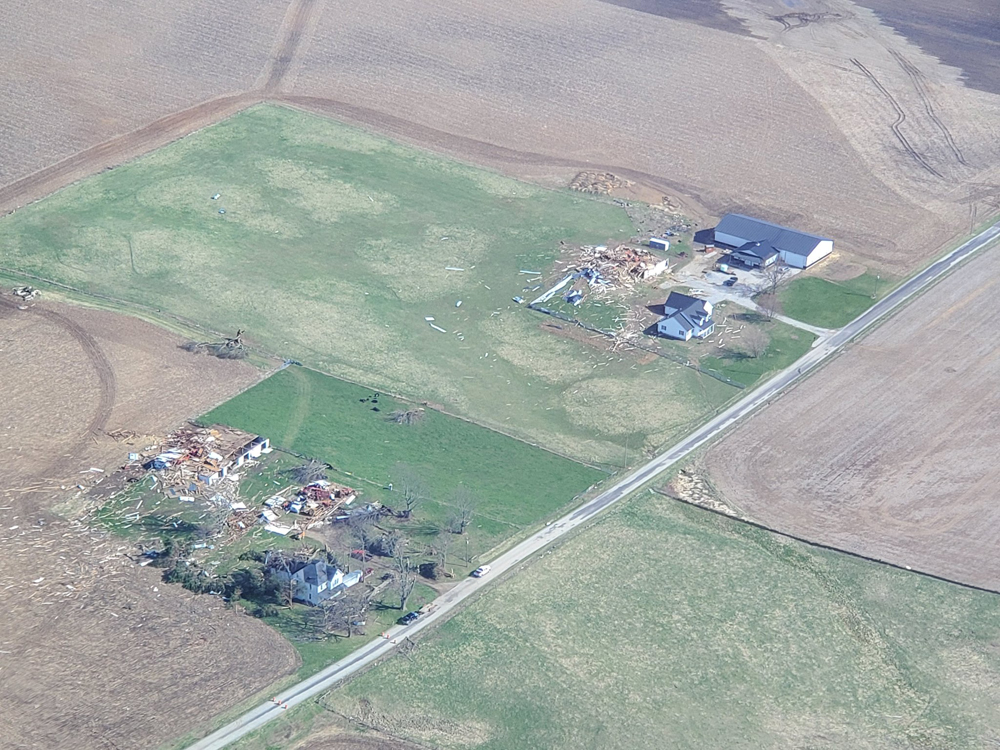
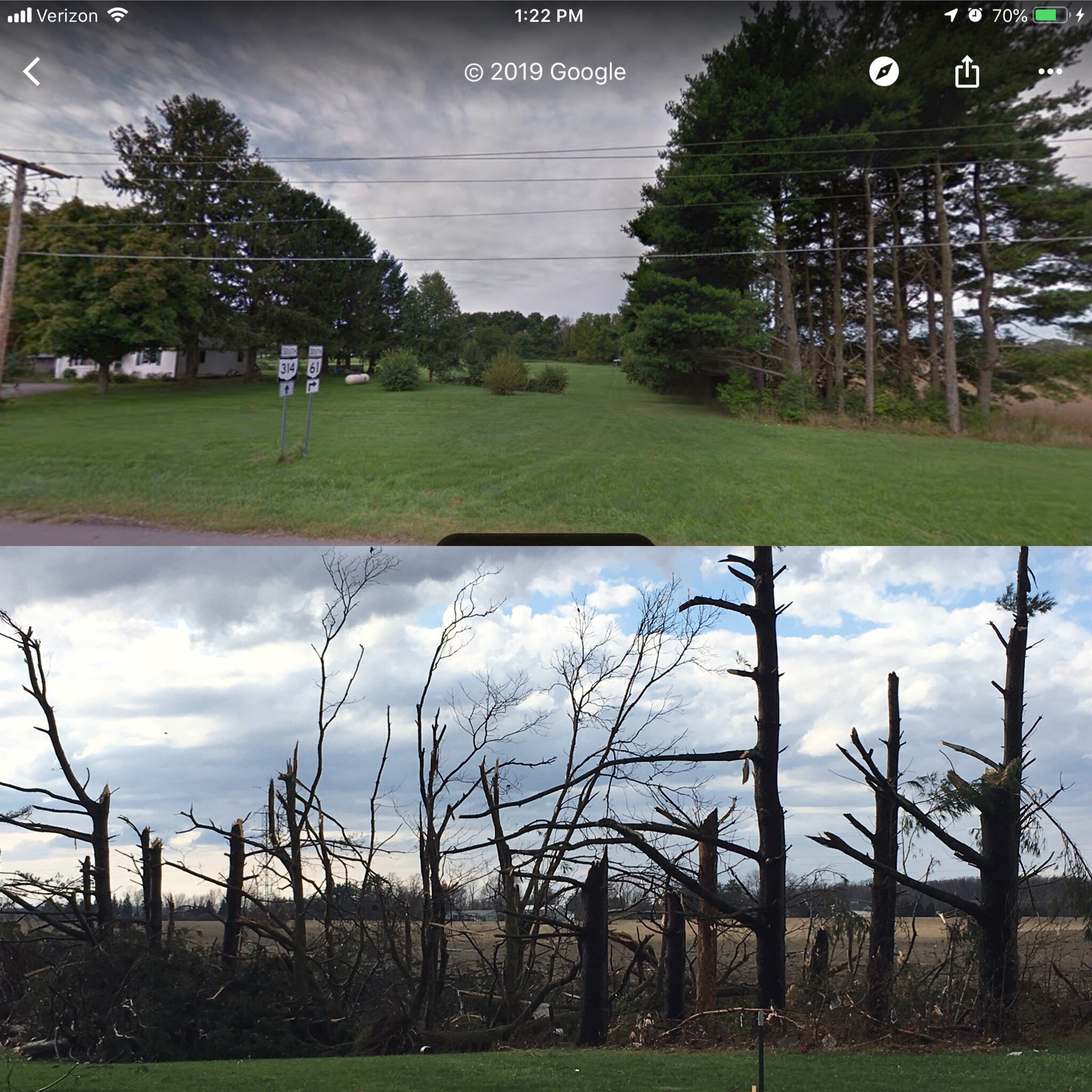
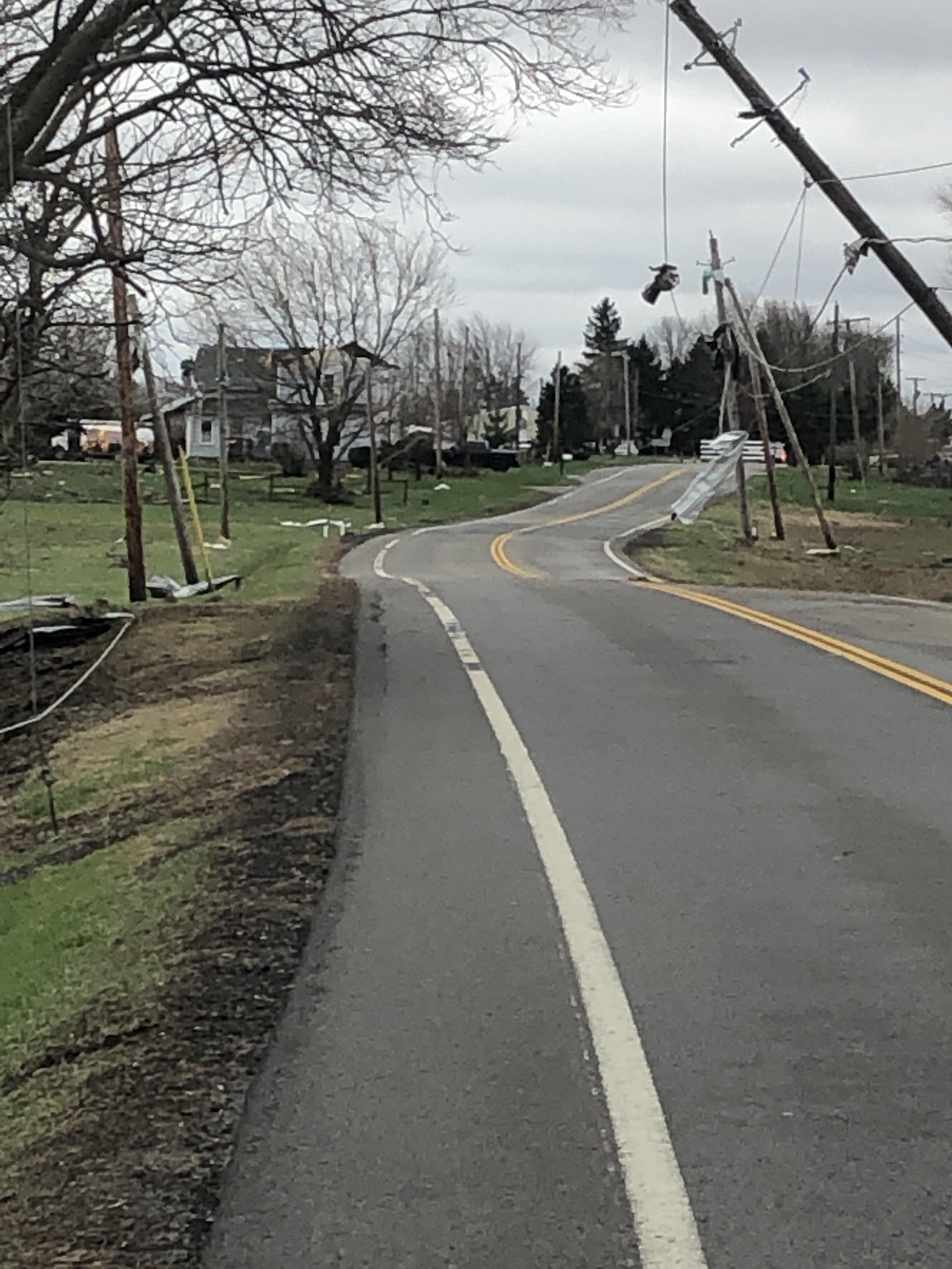
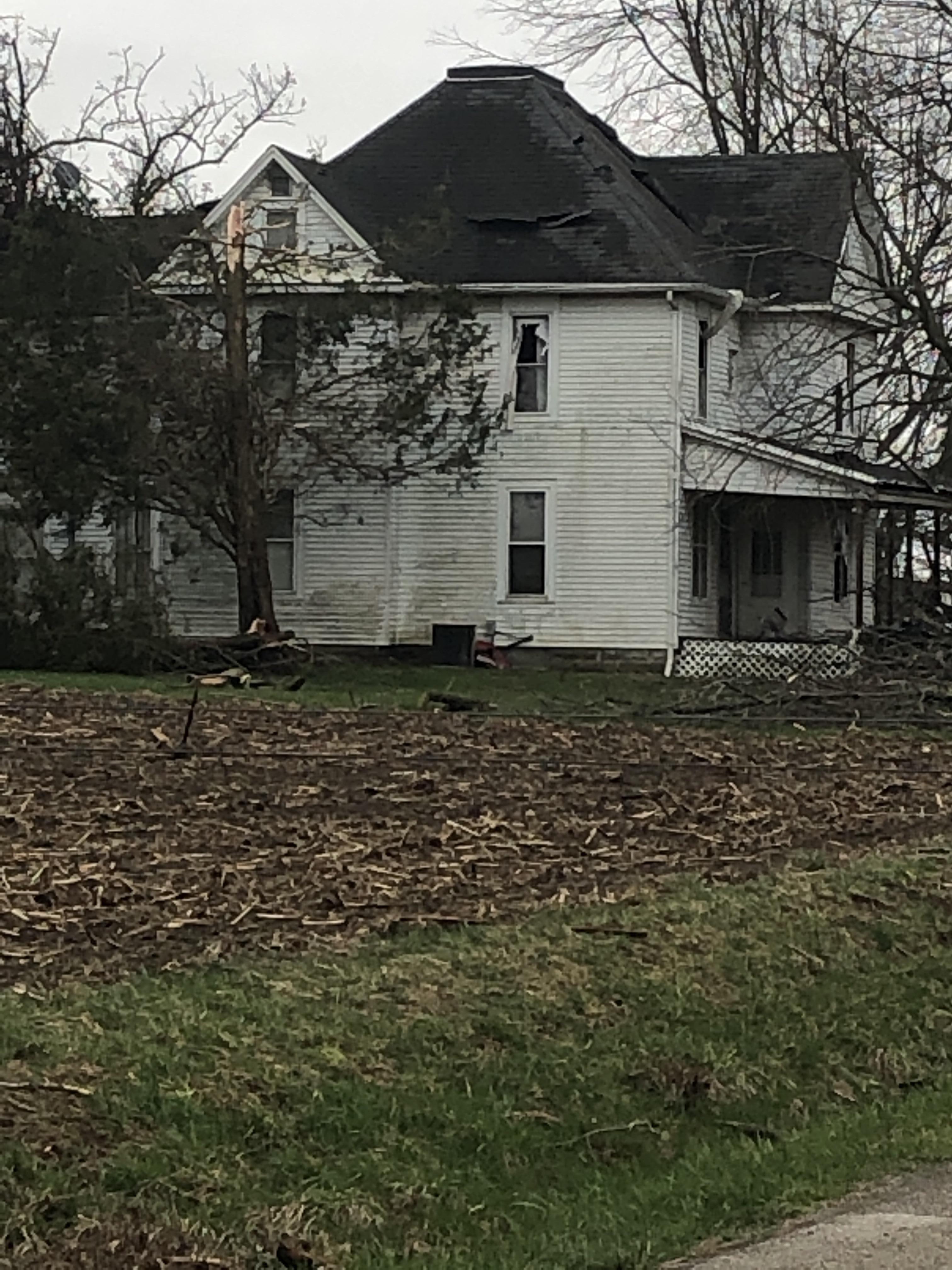
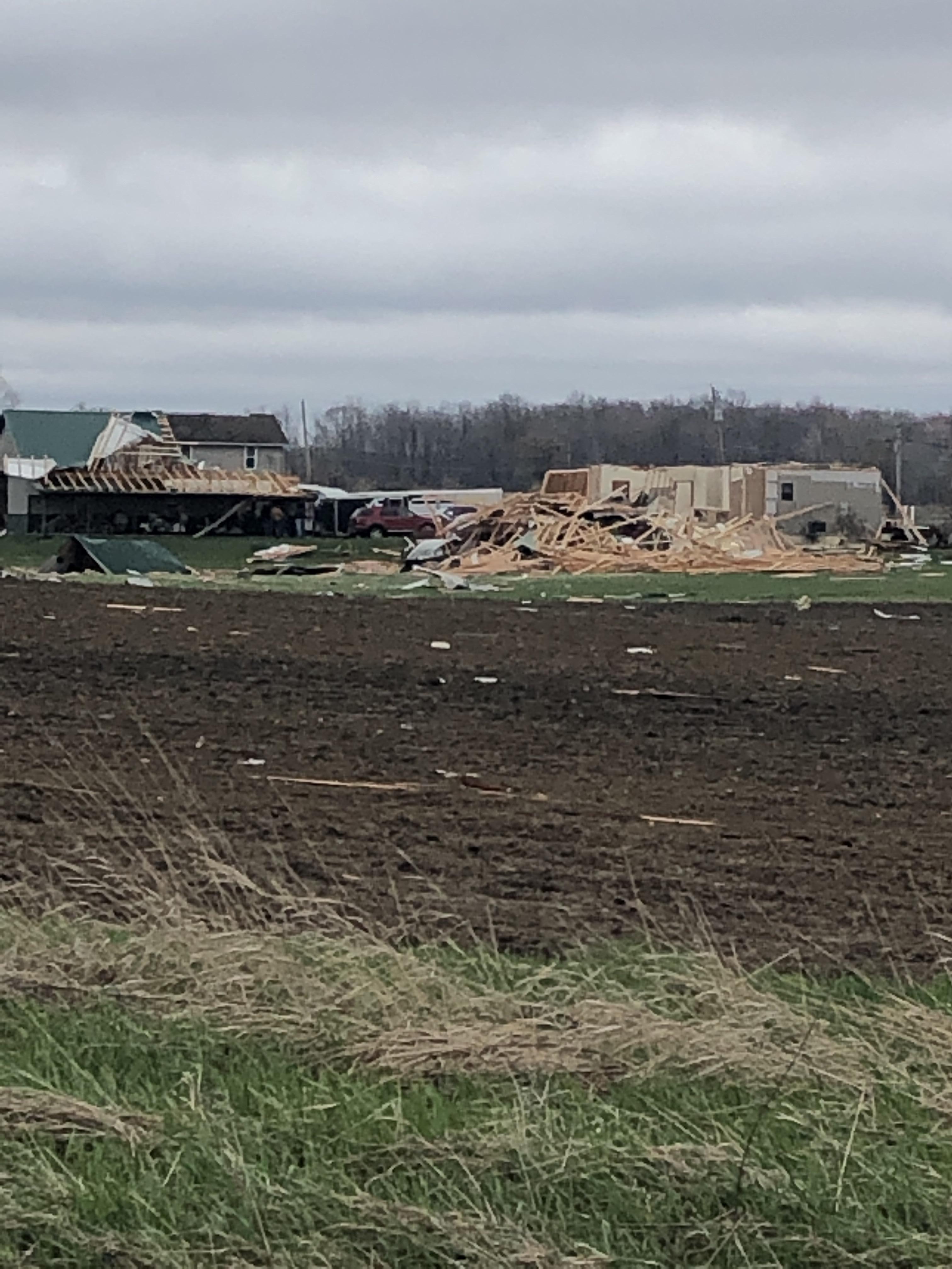
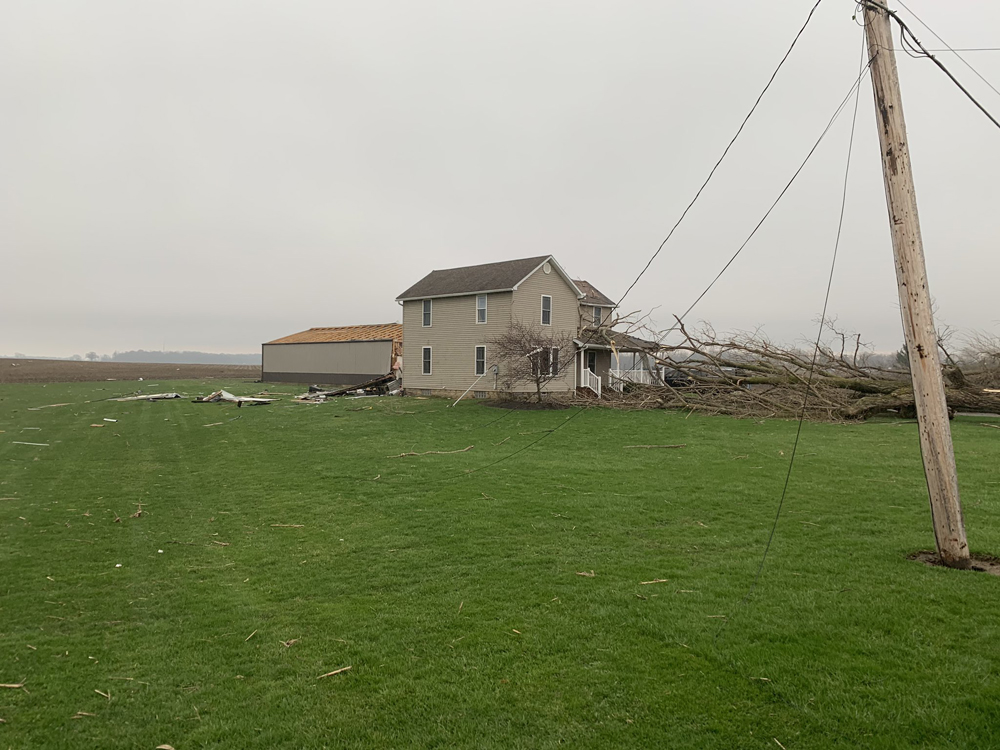
According to the NWS, the most significant damage was located on the southeast and east side of Shelby from the Chevy dealership on state Route 39 northeastward to state Route 96, where a home was significantly damaged. That location is where the tornado reached its maximum width.
Video provided by Brit Wager
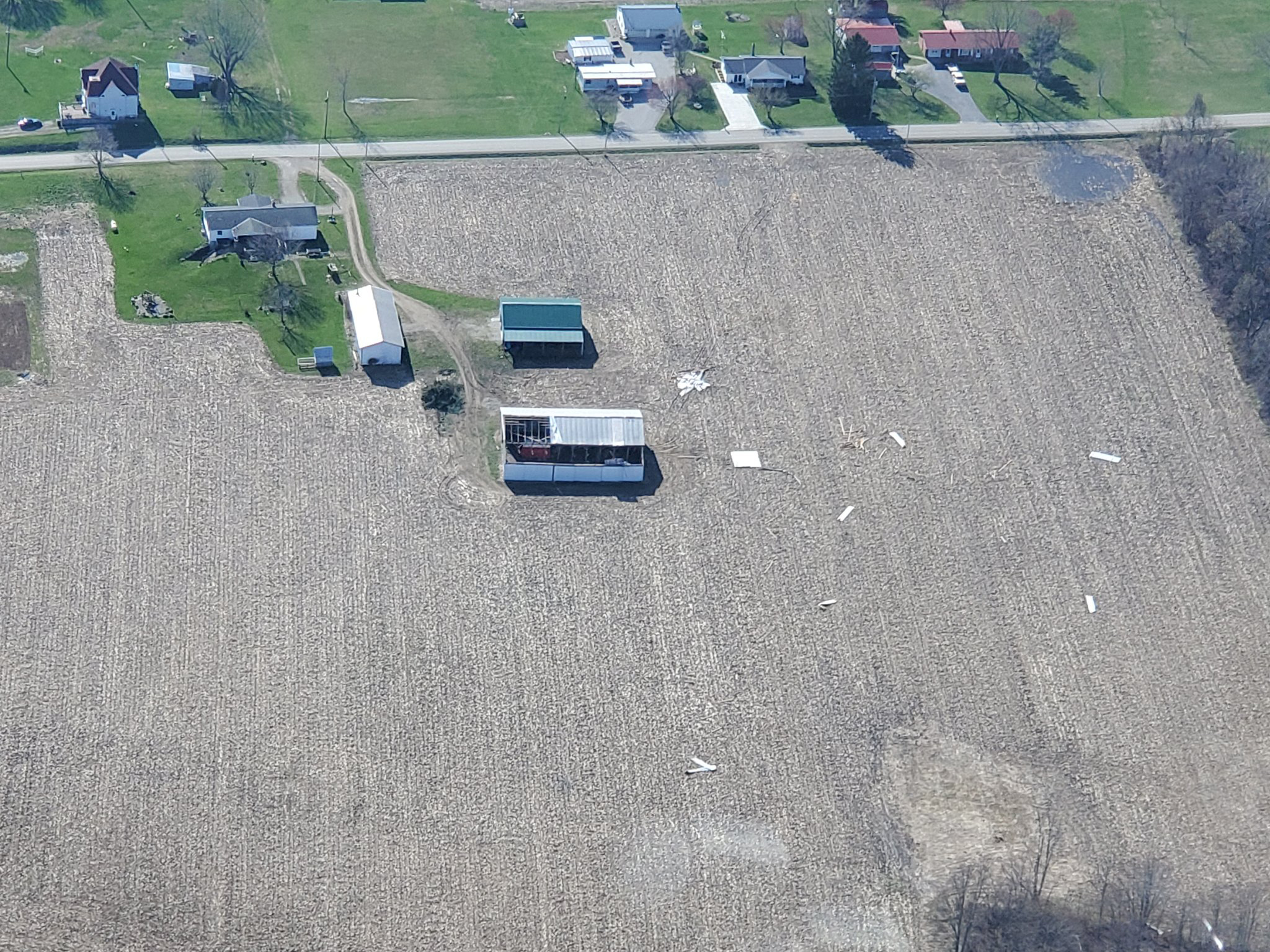
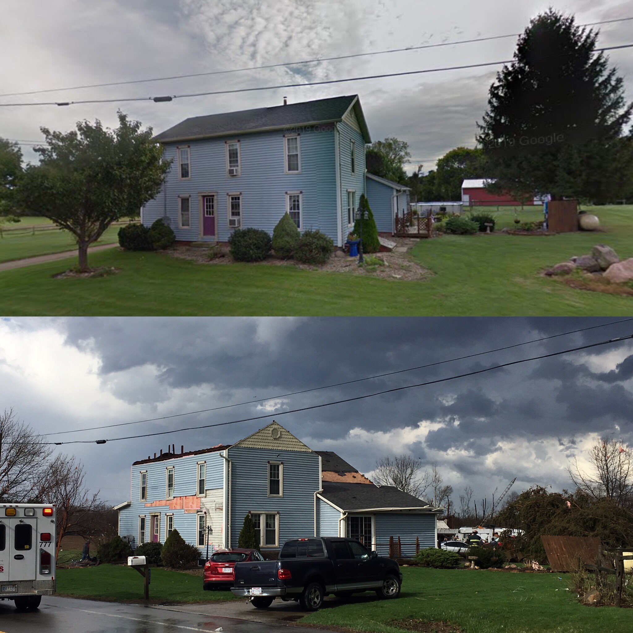
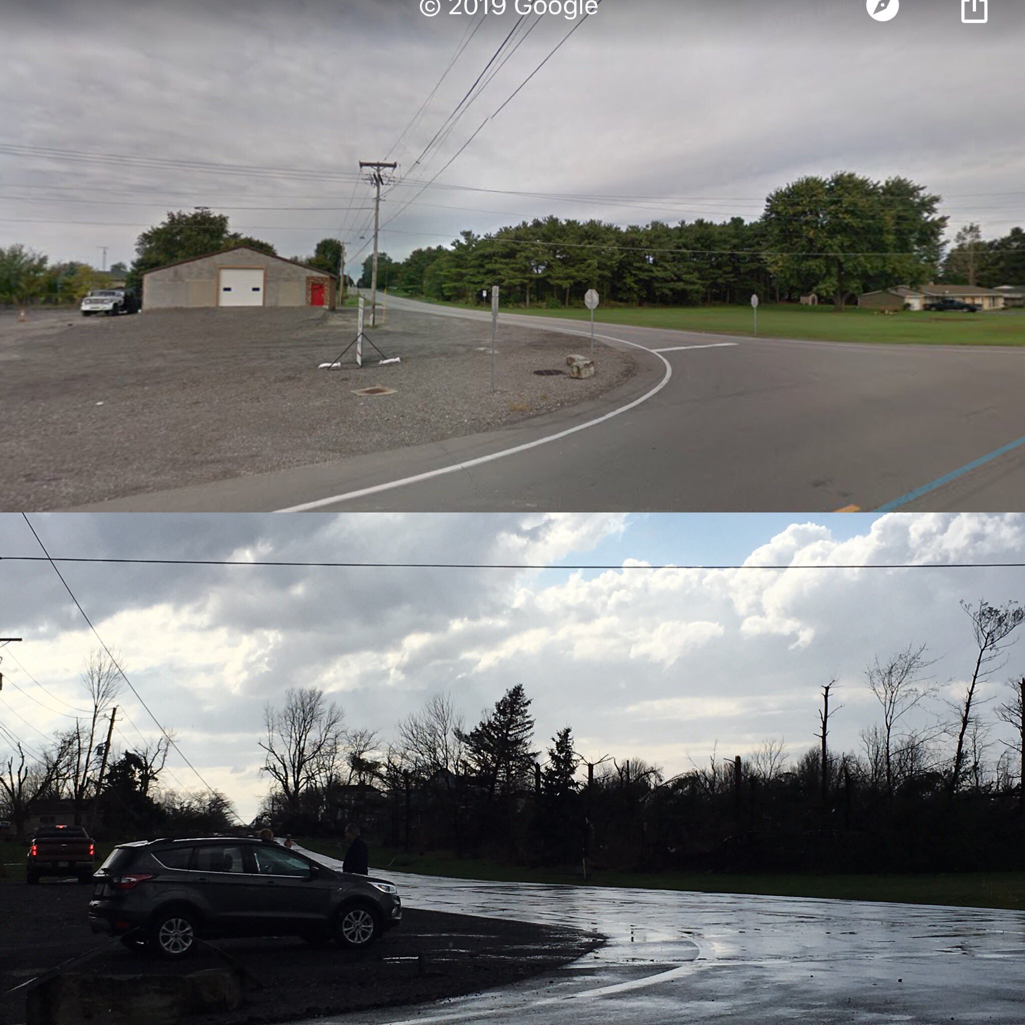
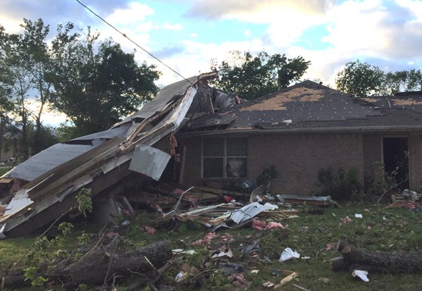
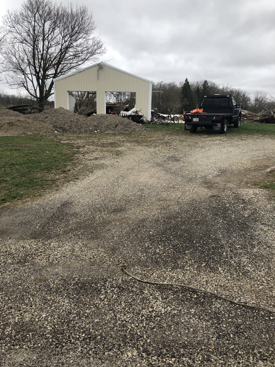
About a half-dozen homes were damaged and at least six people were taken to a hospital to be treated for storm-related injuries.
Six people were injured in the storm.
|
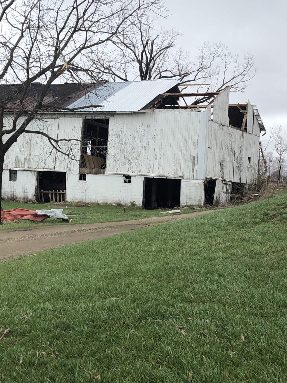
Pictures of storm damage in/around Shelby, OH |
||
 |
 |
 |
 |
 |
 |
 |
 |
 |
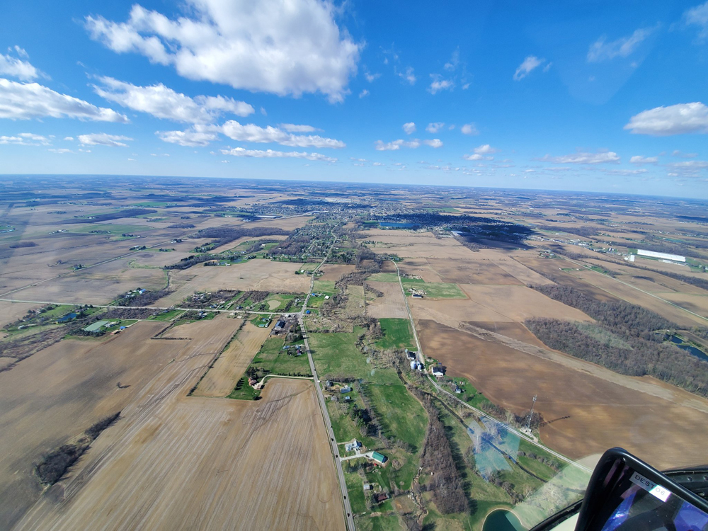
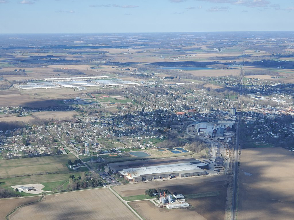
The National Weather Service sent out storm damage survey teams across parts of Ohio after severe storms blasted the state on Sunday. There were nearly 100 reports of either damaging winds, hail and even what some that were tornadoes that swept through the area.
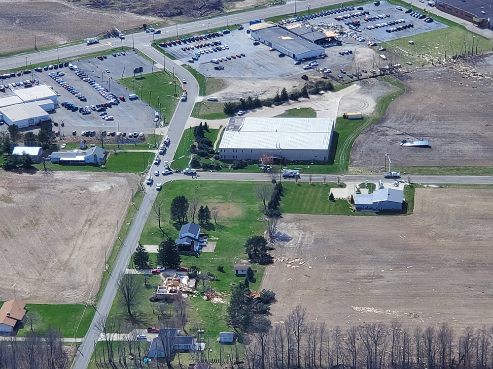
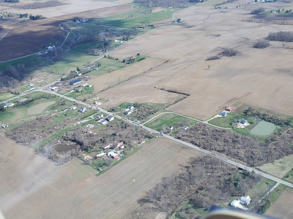
| Flyover photos (courtesy of WEWS-TV Brian Shaw) Shelby, OH | ||
 |
 |
 |
 |
 |
 |
 |
 |
 |
 |
 |
 |
This morning, emergency management officials in Richland County along with a team from the National Weather Service in Cleveland confirmed that an EF-2 tornado touched down in the small town of Shelby, just north of Mansfield Sunday afternoon. The tornado touched down around 4:42pm and tracked for 17 miles through northern Richland County. The tornado had estimated peak wind speeds of up to 125 mph and may have had a width of 1/2 mile.
| Rocket Chevrolet in Shelby | ||
 |
 |
 |
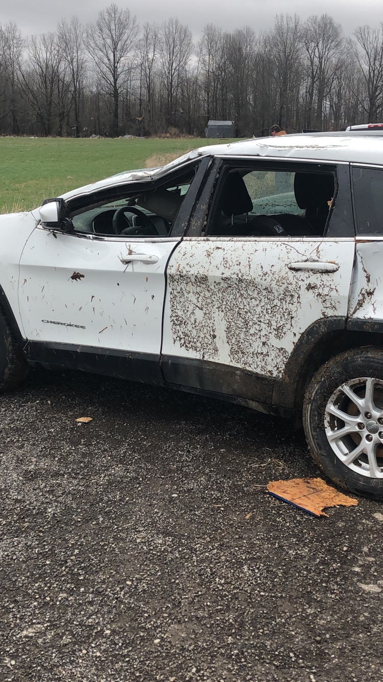
A long track tornado began about 3 miles southwest of Shelby around 442 PM then tracked northeast to about 5 miles north of Olivesburg. EF 1 damage was seen along much of its 17 mile track. The most significant damage was located on the southeast and east side of Shelby from near the Chevy Dealership along State Route 39 northeastward to State Route 96 where a home was significantly damaged. This is where the EF 2 damage was observed and the tornado reached its maximum width of 1/2 mile. One vehicle was tossed 100 feet into the air with 2 people inside. The vehicle rolled multiple times before coming to a stop. Both persons inside the vehicle were luckily unharmed.
 |
 |
 |
 |
 |
 |
 |
 |
 |
 |
 |
 |
April 14, 2019 – Severe Storms, Damaging Winds, and 3 Tornadoes
Low pressure near Cincinnati on Sunday morning of April 14 tracked northeast across Ohio along a northward moving warm front to just south of Erie, Pennsylvania by evening. An extensive area of stratiform rain in the morning cleared away and allowed for partial clearing which aided destabilization along with warm advection. Temperatures behind the warm front surged into the lower 70s across North Central and Northeast Ohio. With dew point values in the low 60s, mixed layer CAPE rose above 500 J/KG. Wind shear was also high with effective shear from 65-85 knots and 0-1 km shear of 30-40 knots.
 |
 |
 |
 |
 |
 |
This combination of favorable ingredients resulted in a supercell thunderstorm developing near Marion, OH before 4 pm that tracked northeast across Crawford and Richland Counties. An EF-2 tornado touched down 3 miles SW of Shelby and lifted 5 miles north of Olivesburg for a track of 17 miles. Meanwhile a quasi-linear convective system(QLCS) rapidly developed over central Ohio and moved northeast while intensifying. The QLCS moved into Pennsylvania and attained maximum intensity. The QLCS exhibited several severe indicators with large hail (2” Wattsburg) with a rear inflow jet of 60-65 knots. The large hail caused considerable damage to the siding of several homes and buildings. Another tornado touched down near Canal Fulton in Stark County. This tornado was rated an EF-0 with an intermittent path of damage tracking 3.6 miles. A third brief EF-0 tornado touched down in Springboro, PA and tracked a third of a mile. Details on all 3 tornadoes follow below.