SPC Center Public Severe Weather Outlook (PWO)
2024-04-27
Public Severe Weather Outlook


PUBLIC SEVERE WEATHER OUTLOOK
NWS STORM PREDICTION CENTER NORMAN OK
0649 AM CDT SAT APR 27 2024

...Severe thunderstorms expected over parts of the southern and
central Great Plains today through tonight...

* LOCATIONS...
  Oklahoma
  North Texas
  Kansas
  Western Missouri

* HAZARDS...
  Several tornadoes, a few intense
  Widespread large hail, some baseball size
  Scattered damaging winds, some hurricane force

* SUMMARY...
  Numerous severe thunderstorms are likely today and tonight
  across the southern and central Plains into the lower to mid
  Missouri Valley. The greatest potential for severe storms will
  be from north Texas into Oklahoma and southeast Kansas, where
  strong tornadoes, very large hail over 2 inches in diameter and
  widespread damaging winds (some over 70 mph), are expected to
  occur. A broader area of severe threat will extend from
  south-central Texas north-northeastward to the Great Lakes.

Preparedness actions...

Review your severe weather safety procedures for the possibility
of dangerous weather today. Stay tuned to NOAA Weather Radio,
weather.gov, or other media for watches and warnings. A tornado
watch means that conditions are favorable for tornadoes to form
during the next several hours. If a tornado warning is issued for
your area, move to a place of safety, ideally in a basement or
interior room on the lowest floor of a sturdy building.
SPC Apr 27, 2024 1630 UTC Day 1 Convective Outlook
2024-04-27
SPC 1630Z Day 1 Outlook

Day 1 Convective Outlook
NWS Storm Prediction Center Norman OK
1125 AM CDT Sat Apr 27 2024

Valid 271630Z - 281200Z

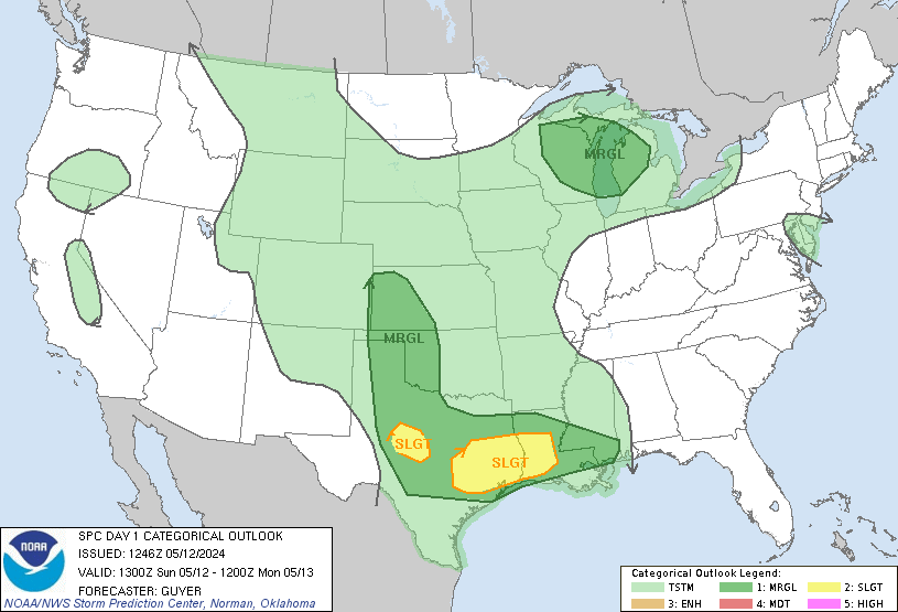
...THERE IS A MODERATE RISK OF SEVERE THUNDERSTORMS THIS AFTERNOON
AND EVENING ACROSS PORTIONS OF SOUTHERN KANSAS...MUCH OF
OKLAHOMA...AND NORTHWEST TEXAS....

...SUMMARY...
Severe thunderstorms are likely today and tonight across the
southern and central Plains into the lower to mid Missouri Valley.
The most numerous/intense storms are expected from north Texas into
Oklahoma and southeast Kansas, where strong tornadoes, very large
hail of 2-3 inches in diameter and damaging winds of 60-80 mph are
all possible.

...A regional outbreak of severe thunderstorms is forecast for this
afternoon and evening across parts of KS/OK.  Very large hail and
strong tornadoes are possible..

...OK/northwest TX/south-central KS...
Water vapor imagery shows the main upper trough is still back over
southern AZ, with a rapidly ejecting mid/upper level jet streak
nosing into OK/TX.  This lead feature has aided in the development
of severe storms this morning over parts of west TX/OK.  Storms will
develop northeastward through the afternoon into central KS, despite
an expansive anvil shield from the morning convection.  These storms
will pose a risk of very large hail and a few tornadoes through the
afternoon and early evening.

Farther south, the air mass across much of central/western OK and
northwest TX continues to warm/destabilize as temperatures rise
through the mid/upper 70s - eliminating CINH.  Only weak upper
forcing through the afternoon will result in chaotic development of
discrete supercells in a very strongly sheared and very unstable
environment.  Forecast soundings show very steep mid-level lapse
rates, ample low-level moisture, and strong/increasing shear
profiles through the day.  Details of timing and location are
nebulous, but those storms that develop will pose a risk of very
large hail and strong and possibly long-track tornadoes.  The
stronger large-scale forcing will arrive around/after dark, with a
greater eastward surge of storms across central OK expected.  This
activity may organize upscale in bowing segments will an increasing
risk of damaging winds along with hail and tornadoes into southeast
KS and northeast OK tonight.

...Southeast CO into northern KS...
A rather strong surface boundary extends from southeast CO across
much of northern KS.  Relatively strong heating along this boundary
and moderate instability will lead to scattered thunderstorm
development by mid-afternoon along the entire corridor.  Steep
mid-level lapse rates, strong deep-layer shear, and favorable
low-level wind profiles in vicinity of the boundary will pose a risk
of very large hail and a few tornadoes through the afternoon and
early evening.  This activity is expected to build eastward this
evening along the same boundary into parts of southern IA/northern
MO, with a continued risk of large hail along with an increasing
threat of damaging winds.

..Hart/Jewell.. 04/27/2024
SPC Apr 27, 2024 1730 UTC Day 2 Convective Outlook
2024-04-27
SPC 1730Z Day 2 Outlook

Day 2 Convective Outlook
NWS Storm Prediction Center Norman OK
1230 PM CDT Sat Apr 27 2024

Valid 281200Z - 291200Z

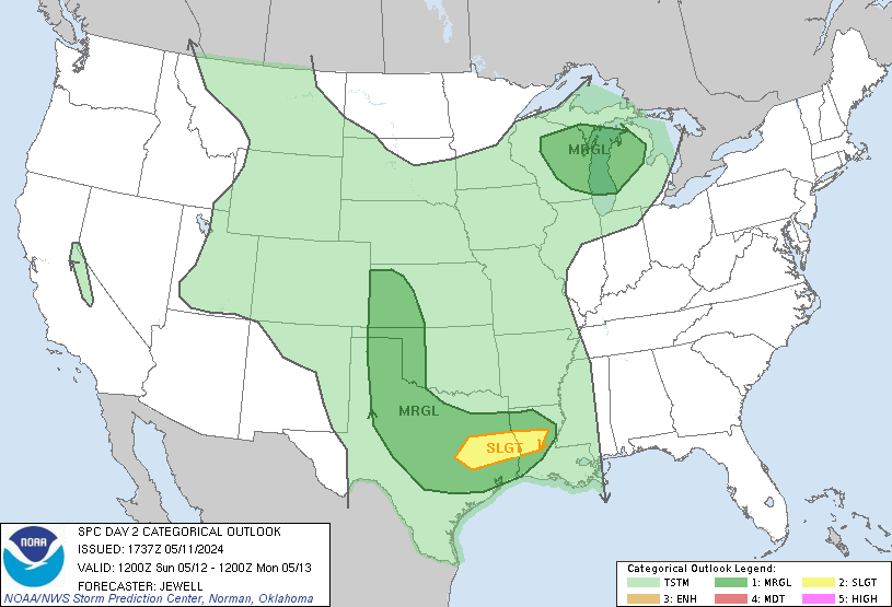
...THERE IS A SLIGHT RISK OF SEVERE THUNDERSTORMS OVER PARTS OF THE
SOUTHERN AND CENTRAL PLAINS INTO THE MISSISSIPPI...

...SUMMARY...
Severe thunderstorms are possible from east Texas into parts of the
upper Mississippi Valley Sunday. Damaging winds, hail, and a few
tornadoes, will all be possible.

...Summary...
A broad, negatively tilted upper trough is forecast to move east
northeastward from the southern/central Plains into the mid MS
Valley and the Midwest Sunday into Sunday night. An attendant
surface low will lift northeast into IA with a dryline trailing
south through eastern NE/KS into central OK. This will serve as a
focus for renewed convective development behind one or more
complicating clusters of ongoing morning storms. Hail, damaging
winds and a few tornadoes are possible.

...East TX into the upper MS Valley...
With broad ascent occurring over an expansive warm sector and mid to
upper 60s F surface dewpoints, one or more clusters of strong to
severe storms are expected to be ongoing early in the period over
the Mississippi Valley into eastern OK/KS and northeast TX. As these
storms continue to move eastward most model guidance shows a general
decrease in severe coverage through the morning hours. However, a
few solutions suggest a line of storms may persist for several hours
with a severe risk across portions of northern AR and southern MO.
With deep meridional shear profiles and limited buoyancy, bands or
clusters of storms capable of isolated damaging winds appear to be
the most likely threat.

Additional redevelopment of more isolated storms is possible ahead
of the dryline across parts of eastern NE/KS, northwest MO and
southern IA closer to the surface low. A few supercells could evolve
with a risk for all hazards. However, confidence in storm evolution
is low with the potential for widespread cloud cover and convection
limiting the extent of the warm sector.

Farther south into northeast TX, eastern OK, and western AR,
redevelopment behind the initial line appears possible from early to
mid afternoon. As the main trough lifts away to the northeast,
low-level warm advection should remain fairly strong and support
weak ascent over much of the warm sector and along the dryline. A
deep and very moist boundary layer with upper 60s to low 70s F
dewpoints will support a broad area of 1500-2000 J/kg of MLCAPE.
However, mid-level lapse rates are expected to remain modest and in
combination with broad/weak ascent and mostly meridional shear
profiles, storms may slowly evolve into clusters and line segments.
Still, strong low-level shear could support storm-scale rotation
with the more semi-discrete convection. Large hail, and a few
tornadoes are possible before storms grow upscale into one or more
linear clusters later in the afternoon into the evening. Damaging
winds and line embedded tornadoes will remain possible as the linear
clusters move eastward into the MS Valley in the evening and through
the overnight hours.

...Upper Midwest/Great Lakes into the Mid Atlantic...
A few stronger storms will be possible Sunday afternoon and evening
from the Great Lakes into northern OH/PA, along the warm front.
Clouds and elevated morning storms are expected to linger through
the day. Instability appears too weak to support an organized severe
threat, though small hail and gusty winds will be possible with a
few stronger storms.

..Lyons.. 04/27/2024
SPC MD 543
2024-04-27
SPC Mesoscale Discussions
MD 0543 CONCERNING TORNADO WATCH 145…146… FOR NORTHEAST OK AND SOUTHEAST KS
Mesoscale Discussion 0543
NWS Storm Prediction Center Norman OK
0154 PM CDT Sat Apr 27 2024

Areas affected...Northeast OK and southeast KS

Concerning...Tornado Watch 145...146...

Valid 271854Z - 272030Z

The severe weather threat for Tornado Watch 145, 146 continues.

SUMMARY...As severe storms in north-central Oklahoma and
south-central Kansas spread east late this afternoon, an additional
tornado watch will likely be needed.

DISCUSSION...The airmass ahead of severe storms in south-central KS
and north-central OK continues to destabilize as surface temps have
warmed in the upper 70s to low 80s across most of eastern OK into
far southeast KS. While low-level shear within this part of the
warm-moist sector is relatively modest per INX VWP data, it will
strengthen based on upstream TLX data. A mix of discrete and
semi-discrete supercells occasionally embedded within clusters
should spread east-northeast through late afternoon. As this occurs,
all severe hazards will be possible, some of which may be
significant.

..Grams.. 04/27/2024

...Please see www.spc.noaa.gov for graphic product...

ATTN...WFO...SGF...EAX...TSA...TOP...ICT...OUN...

LAT...LON   37789675 37989586 38109524 38159465 37499454 36419461
            35639585 35269698 36329742 37079752 37789675
https://www.spc.noaa.gov/products/md/md0543.htmlSPC Mesoscale Discussions
SPC MD 542
2024-04-27
SPC Mesoscale Discussions
MD 0542 CONCERNING SEVERE POTENTIAL…WATCH POSSIBLE FOR MUCH OF WESTERN KANSAS INTO SOUTHEAST COLORADO
Mesoscale Discussion 0542
NWS Storm Prediction Center Norman OK
0115 PM CDT Sat Apr 27 2024

Areas affected...much of western Kansas into southeast Colorado

Concerning...Severe potential...Watch possible

Valid 271815Z - 272045Z

Probability of Watch Issuance...40 percent

SUMMARY...A few severe storms may develop this afternoon near the
front from southeast Colorado into parts of western Kansas, with
large hail the primary threat.

DISCUSSION...Surface analysis shows low pressure over southwest KS,
with a dryline near the OK/TX Panhandle border. A prominent surface
front stretches from southeast CO across west-central KS, with a few
storms already near the central to northeast KS portion of the
front.

Substantial storms are ongoing from northwest OK into south-central
KS near ICT, and this activity has produced outflow which is
affecting destabilization over central KS currently. However,
further heating will likely lead to sufficient instability to
support a few severe storms capable of hail. Northeast surface winds
north of the front will further aid deep-layer shear, and
potentially support left-moving storms with hail potential.

..Jewell/Hart.. 04/27/2024

...Please see www.spc.noaa.gov for graphic product...

ATTN...WFO...ICT...GID...DDC...GLD...PUB...

LAT...LON   38689834 38409900 38160040 37670144 37320192 37130238
            37300316 37980310 38500253 39150090 39649953 39639860
            39309810 38689834
https://www.spc.noaa.gov/products/md/md0542.htmlSPC Mesoscale Discussions
SPC MD 541
2024-04-27
SPC Mesoscale Discussions
MD 0541 CONCERNING TORNADO WATCH 146… FOR NORTHWEST TX TO NORTH-CENTRAL OK
Mesoscale Discussion 0541
NWS Storm Prediction Center Norman OK
0113 PM CDT Sat Apr 27 2024

Areas affected...Northwest TX to north-central OK

Concerning...Tornado Watch 146...

Valid 271813Z - 271945Z

The severe weather threat for Tornado Watch 146 continues.

SUMMARY...Near-term severe threat appears bimodal with discrete
supercells from northwest Texas into southwest Oklahoma, and
separately in north-central Oklahoma with supercells embedded within
a slow-moving cluster.

DISCUSSION...A trio of discrete supercells are ongoing across a part
of northwest TX into far southwest OK, just ahead of the pronounced
dryline. The relatively most favorable thermodynamic environment is
just ahead of these cells. Large hail will be the primary initial
threat, but as supercells mature, the tornado threat should
correspondingly increase amid 0-1 km SRH of 100-200 m2/s2 per FDR
VWP data.

Long-lived cluster with embedded supercell structures has gradually
progressed northeastward over northwest into north-central OK. This
has left a substantial cold pool in its wake with surface
temperatures in the upper 50s to low 60s, minimizing the severe
threat to its northwest in the near-term. Given the cluster
aligning nearly parallel to the deep-layer shear vector, the primary
severe threat will likely be confined along the immediate leading
edge of this cluster within small-scale bowing structures
approaching the I-35 corridor.

..Grams.. 04/27/2024

...Please see www.spc.noaa.gov for graphic product...

ATTN...WFO...TSA...FWD...OUN...SJT...LUB...

LAT...LON   33490031 34609970 35809921 36369852 36919814 36879703
            36529679 35539765 34439786 32939939 32650001 32950044
            33490031
https://www.spc.noaa.gov/products/md/md0541.htmlSPC Mesoscale Discussions

