Skip to content
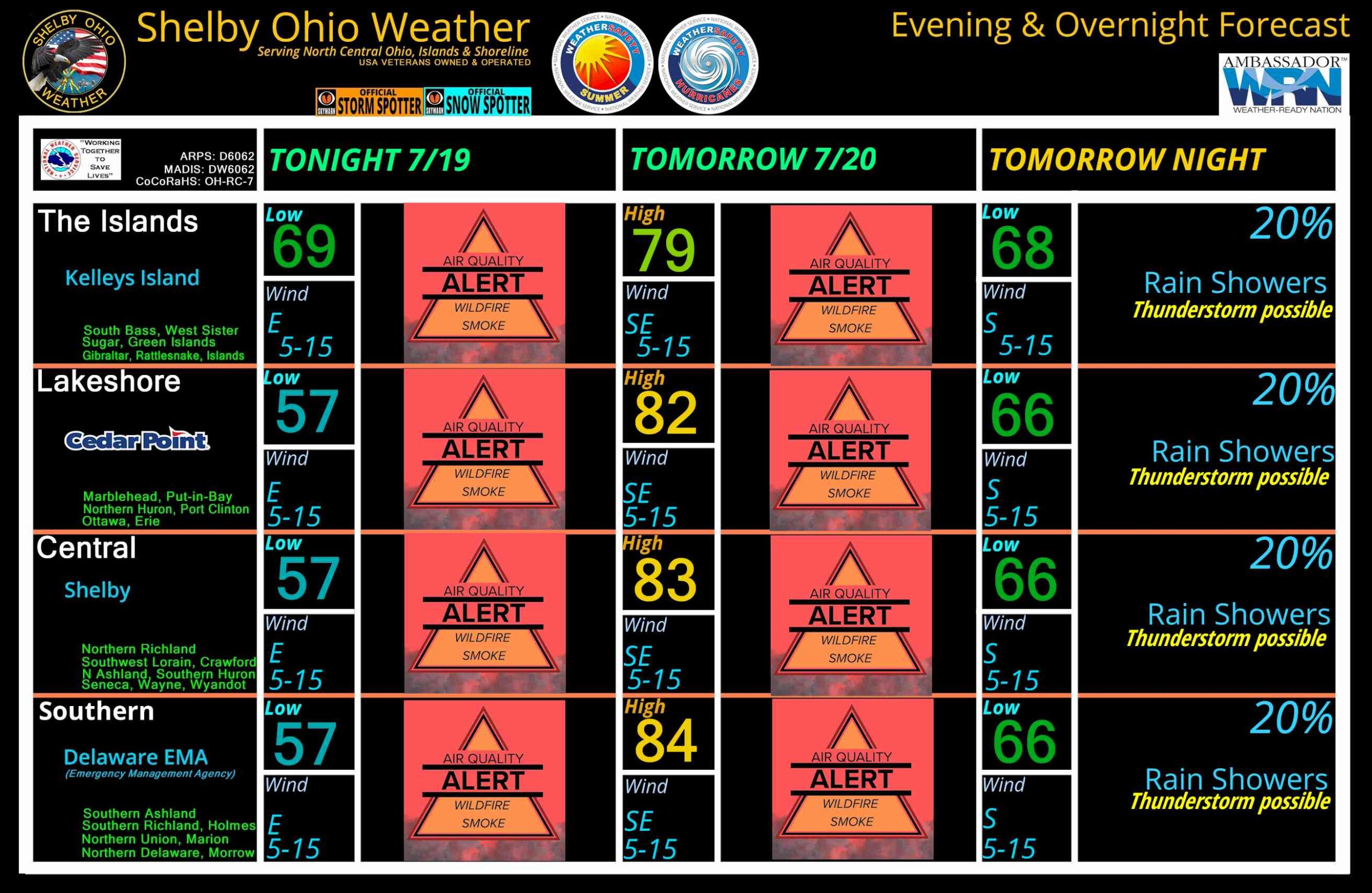
North Central Ohio Overnight forecast July 19-20, 2026
July 19, 2026
by
ShelbyOhWx
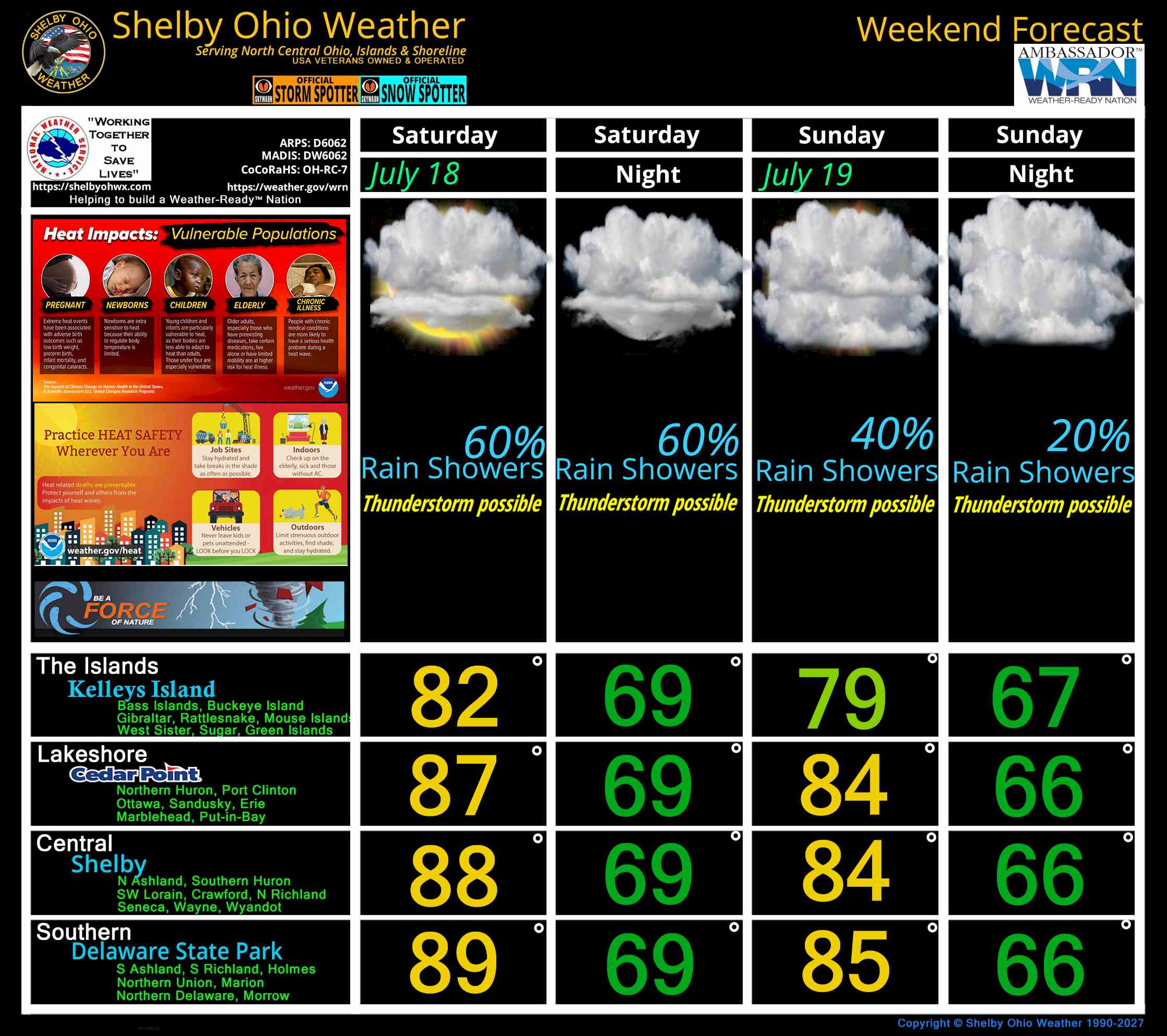
North Central Ohio Weekend forecast for July 18-19, 2026
July 17, 2026
by
ShelbyOhWx
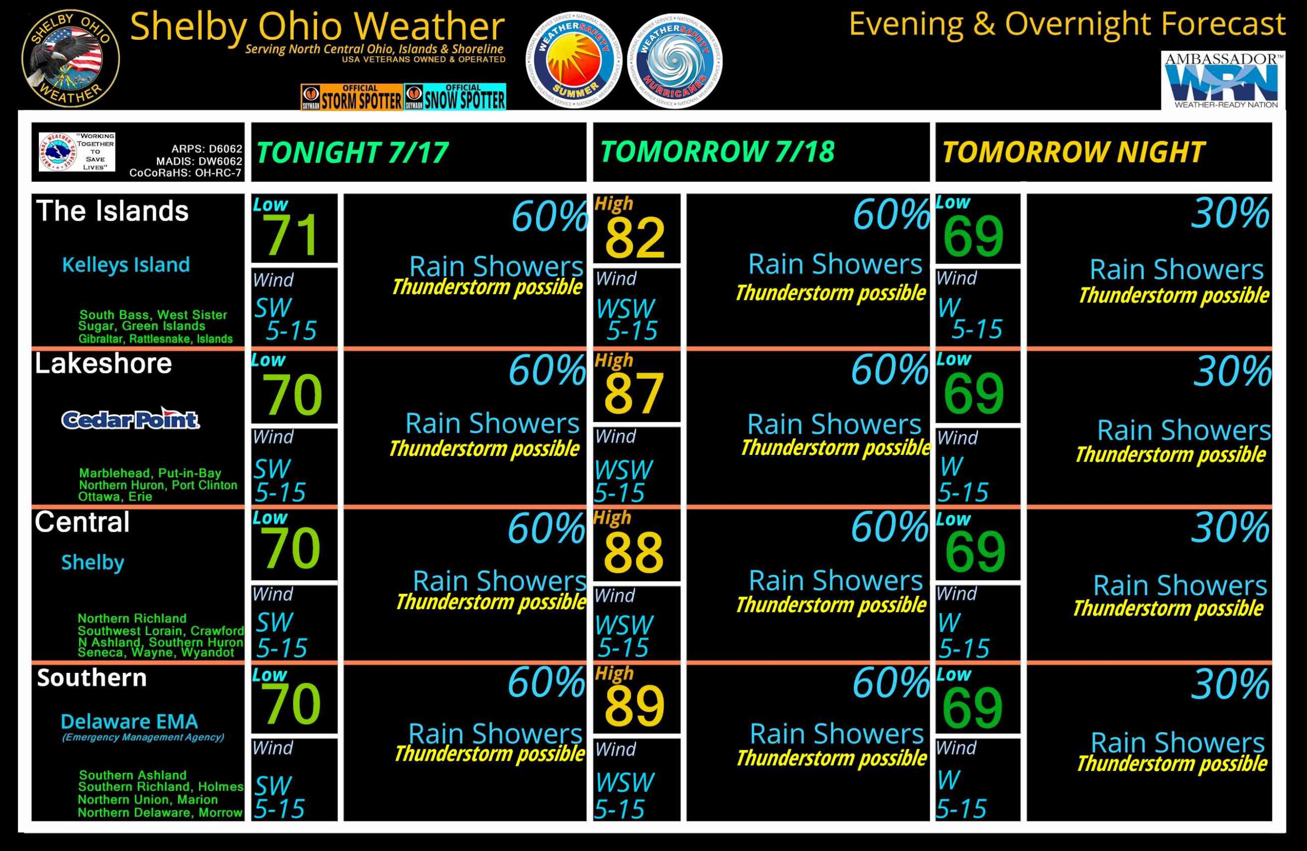
North Central Ohio Overnight forecast July 17-18, 2026
July 17, 2026
by
ShelbyOhWx
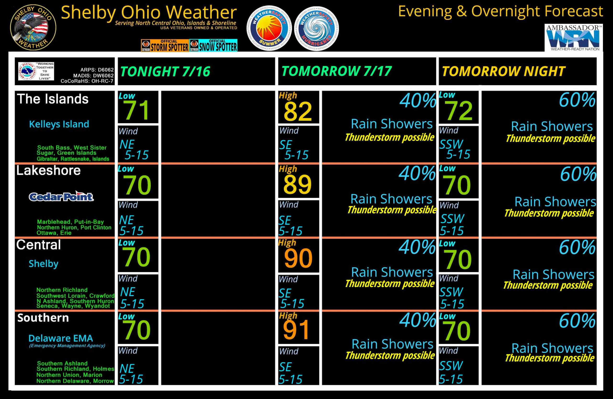
North Central Ohio Overnight forecast July 16-17, 2026
July 16, 2026
by
ShelbyOhWx
Newer posts
←
Previous
Page
1
…
Page
11
Page
12
 Skip to content