Skip to content
ShelbyOhWx
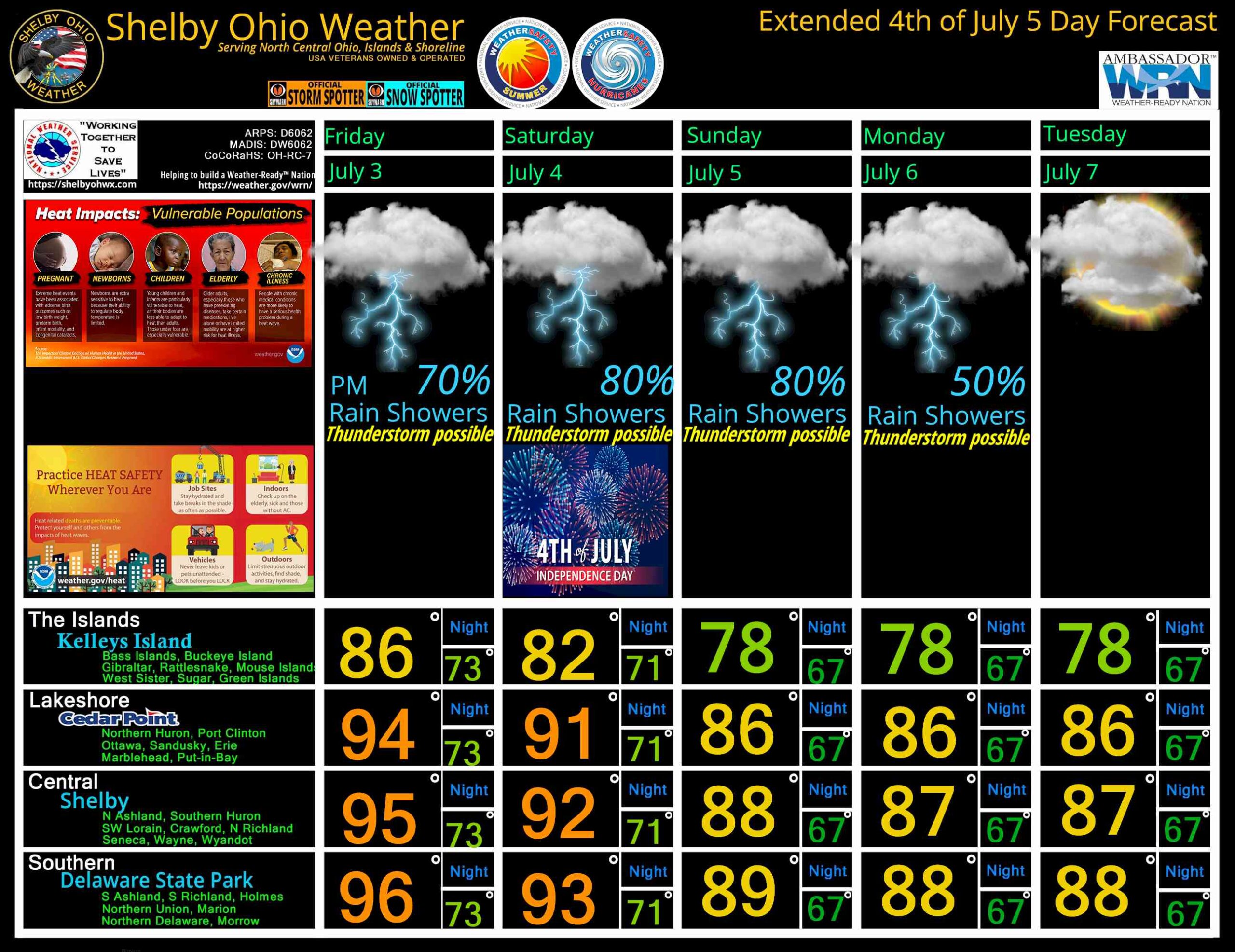
North Central Ohio 4th Extended 5 day Forecast July 3-7, 2026
July 5, 2026
July 2, 2026
by
ShelbyOhWx
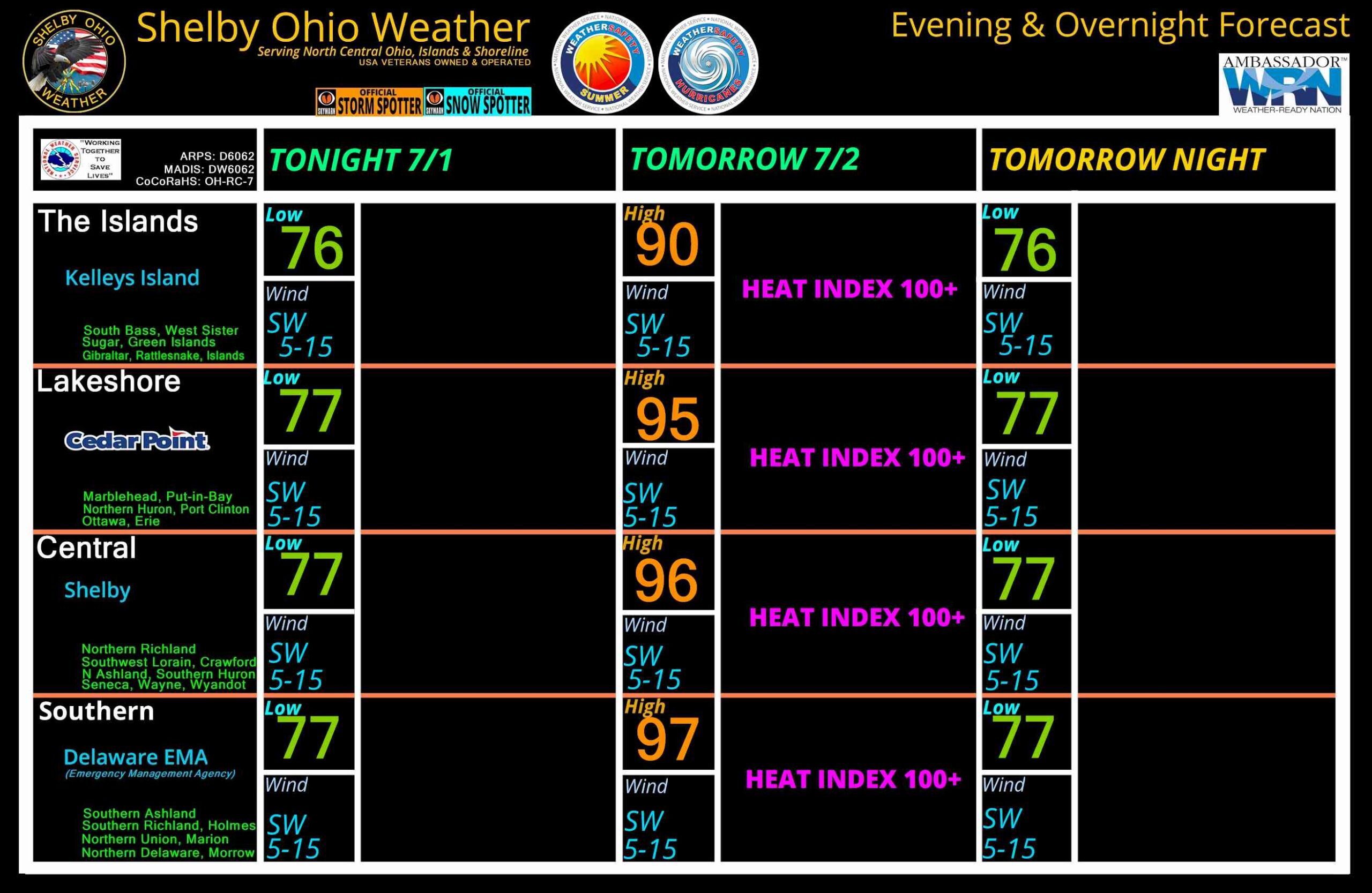
North Central Ohio Overnight forecast July 1-2, 2026
July 1, 2026
by
ShelbyOhWx
North Central Ohio 5 Day forecast for June 29 – July 3, 2026
July 2, 2026
June 28, 2026
by
ShelbyOhWx
Newer posts
←
Previous
Page
1
Page
2
 Skip to content