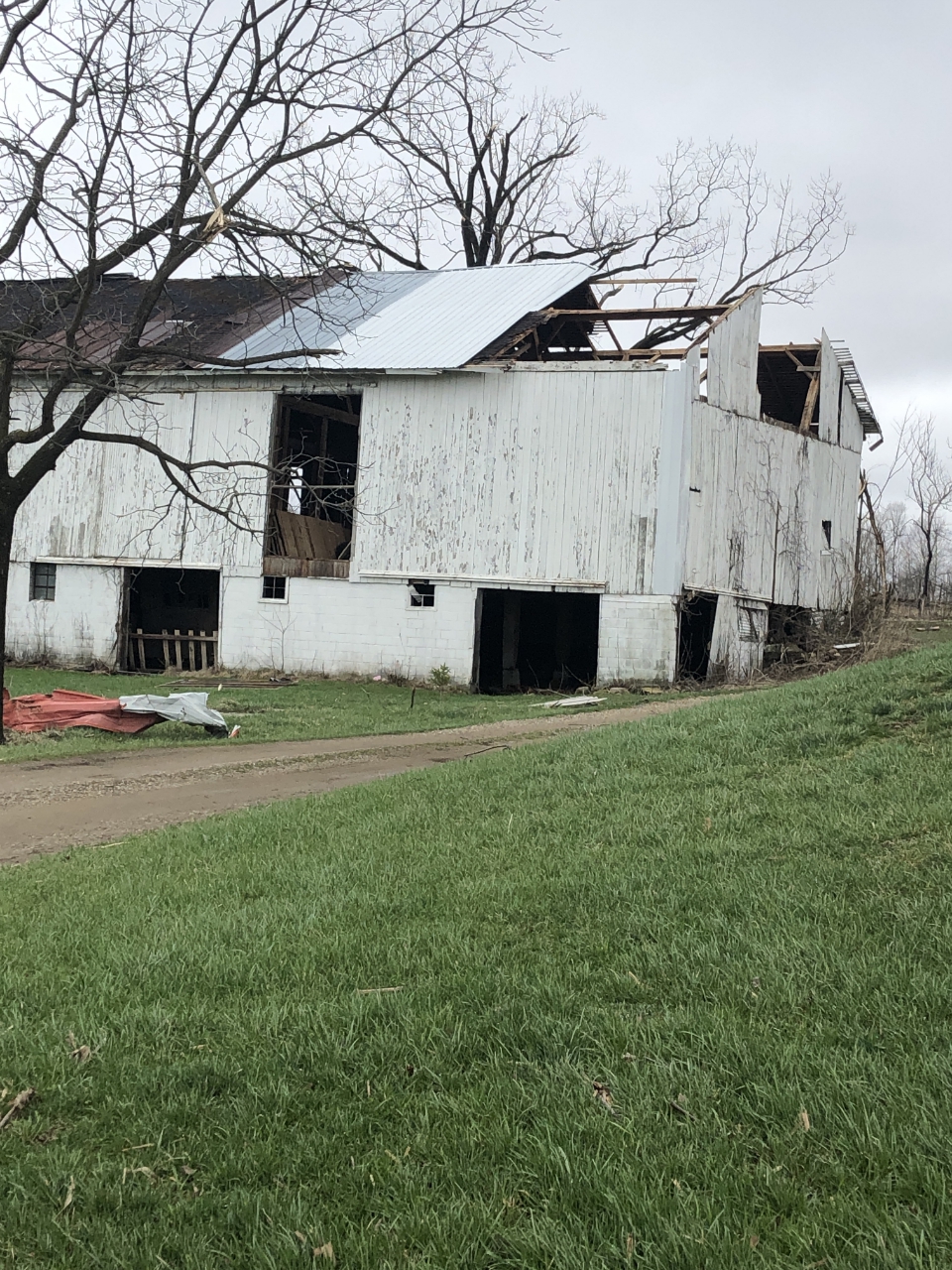
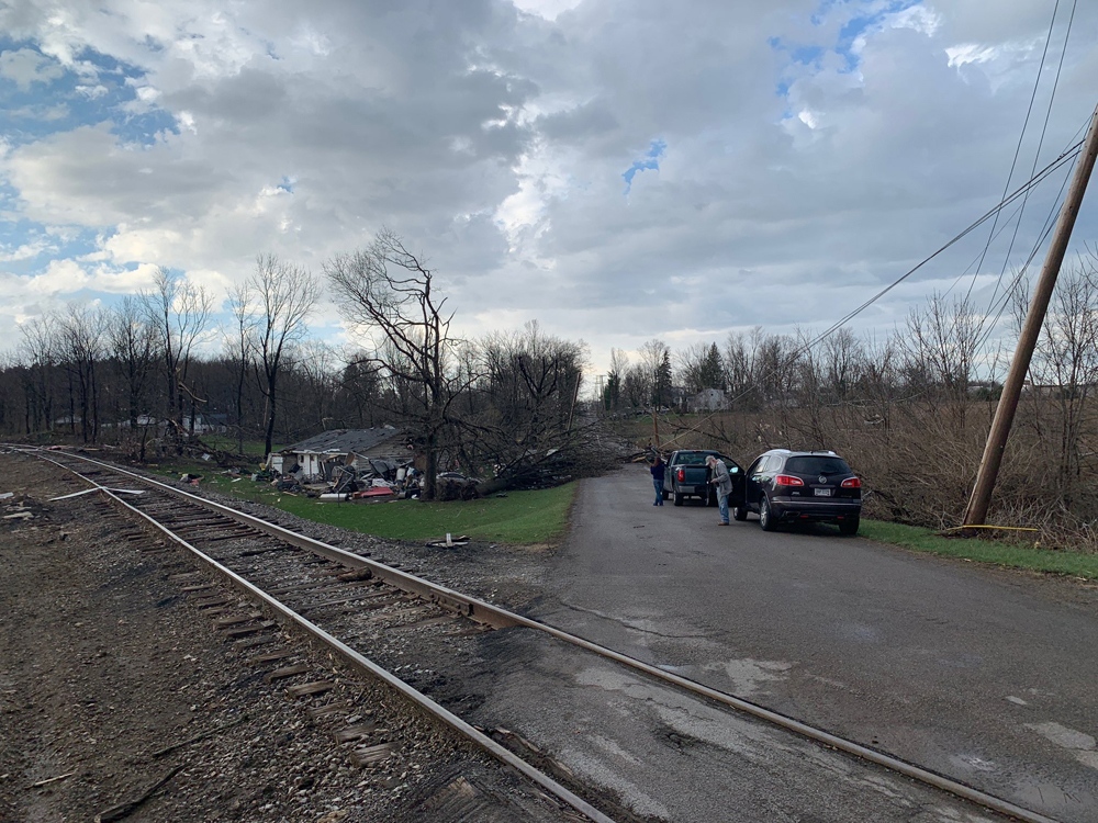
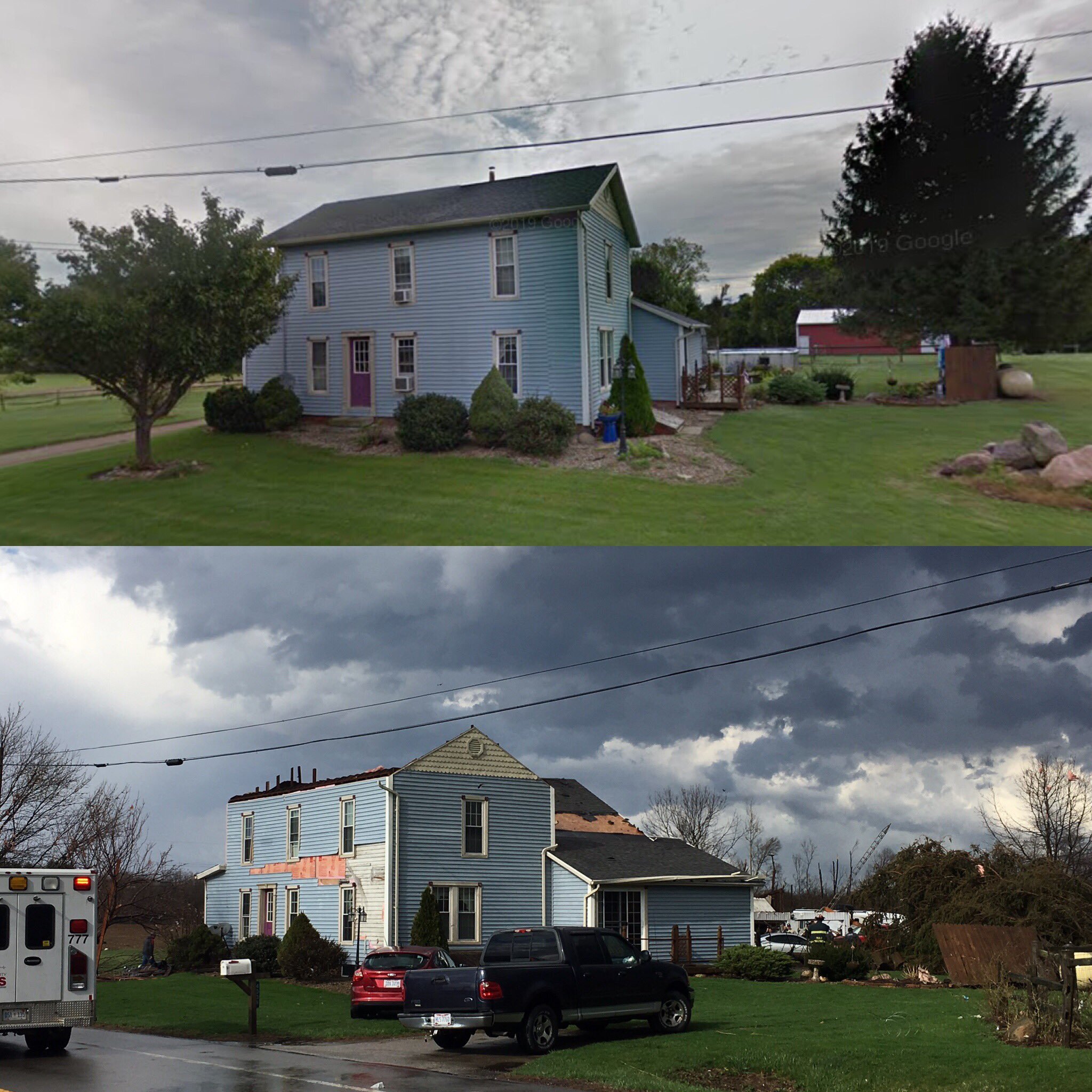
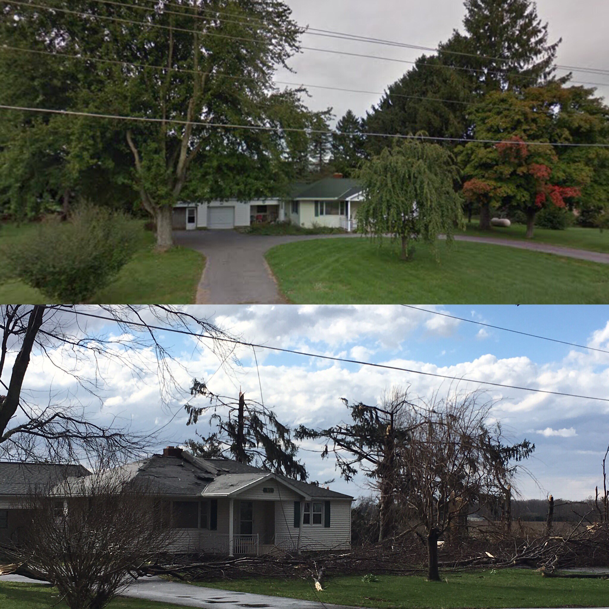
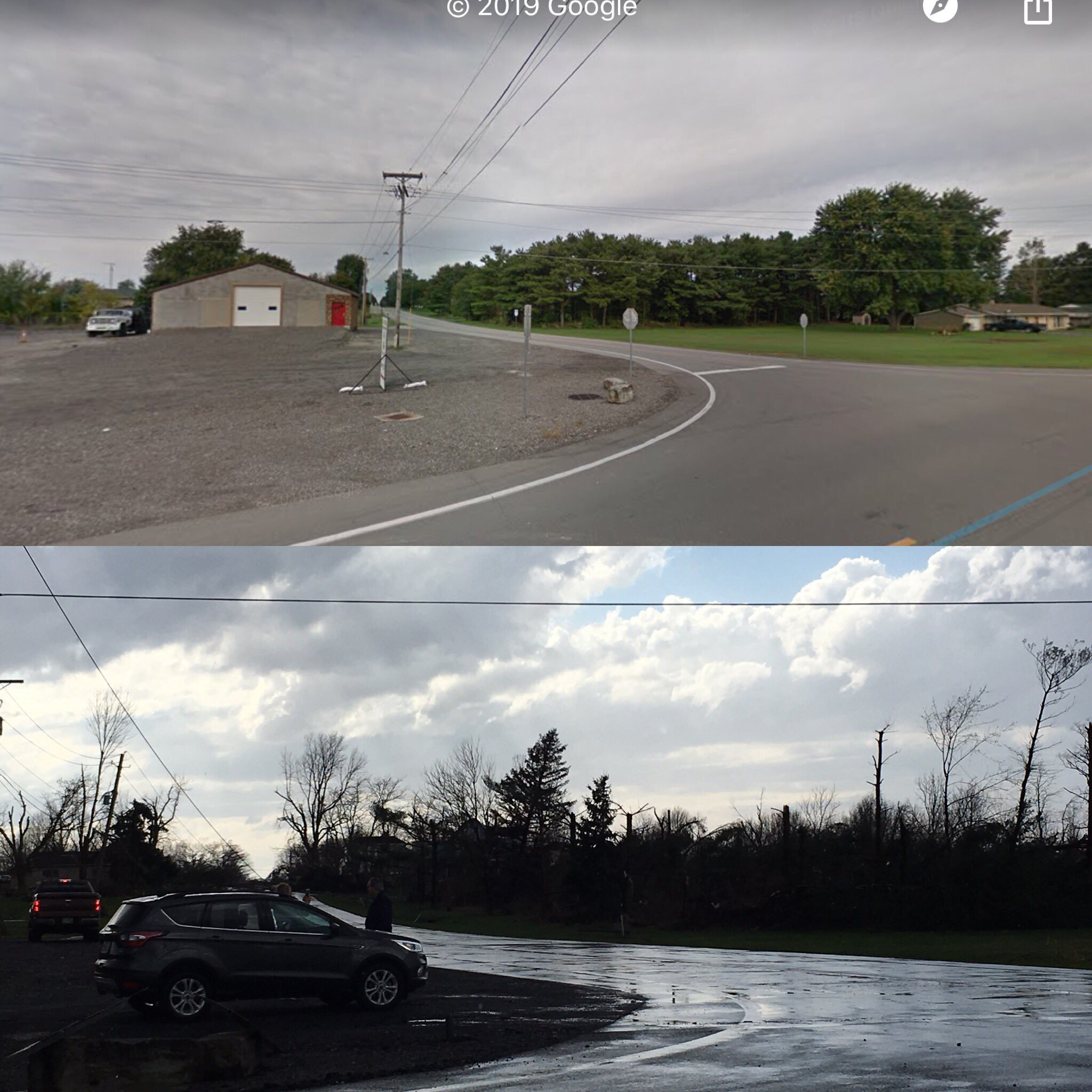
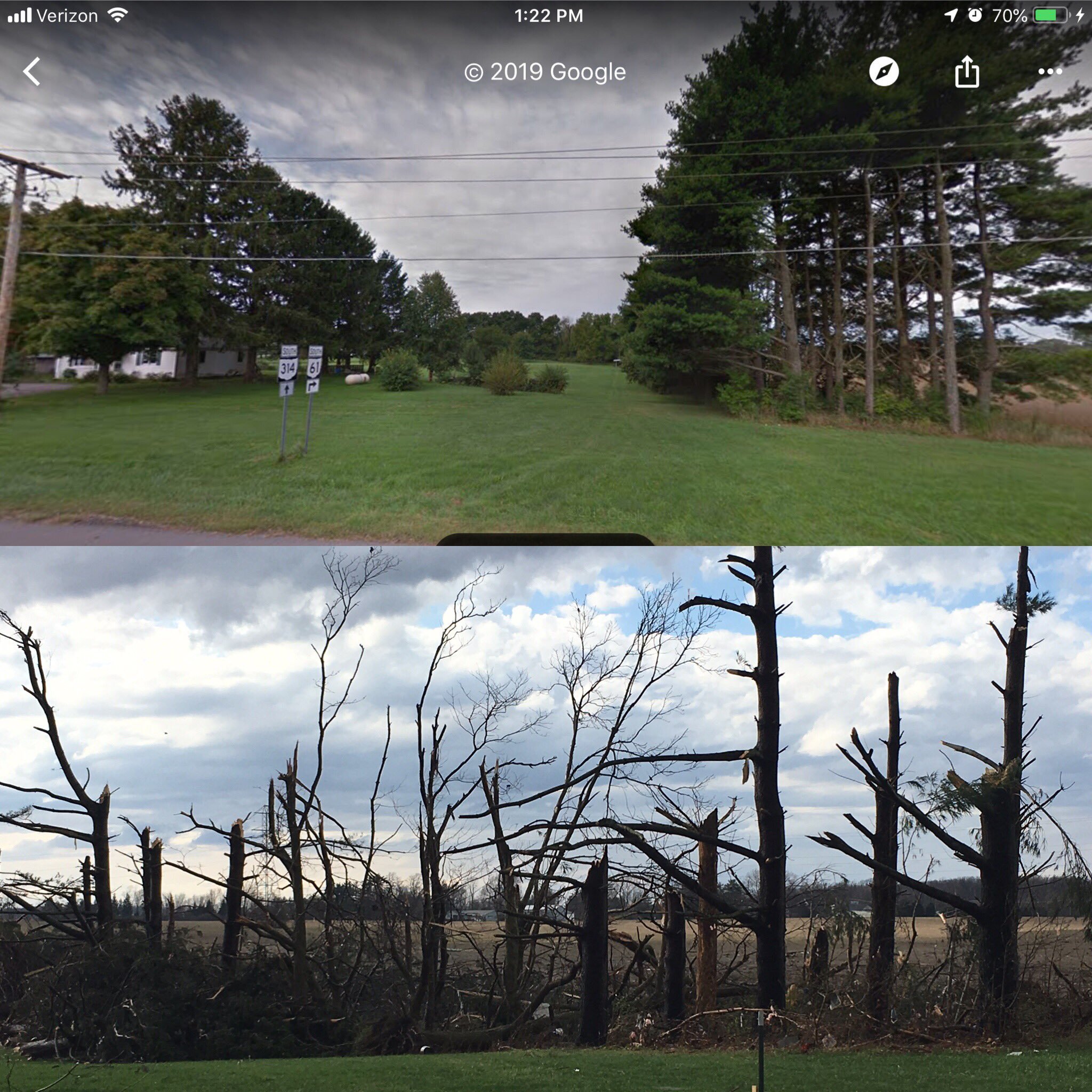
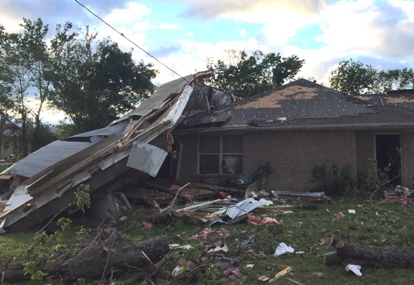
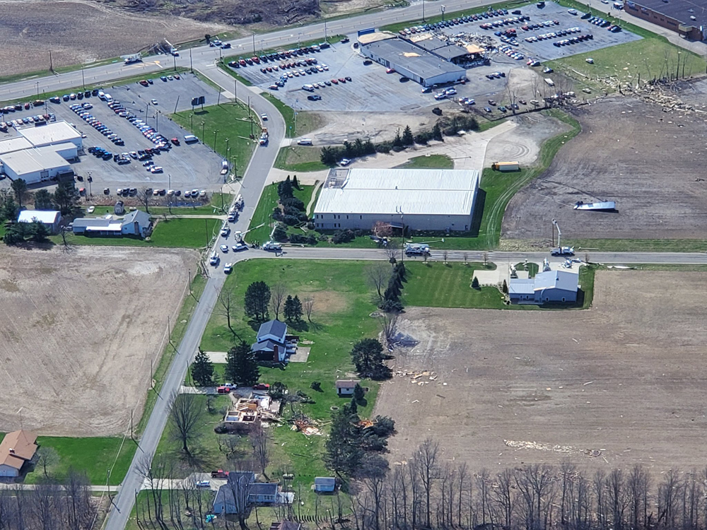
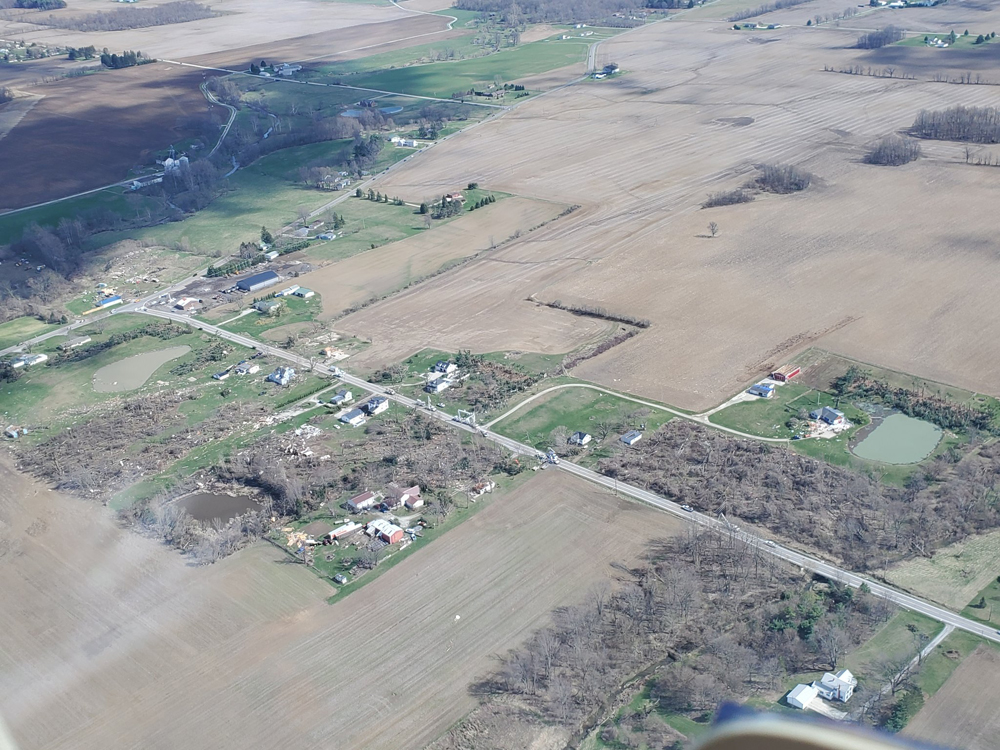
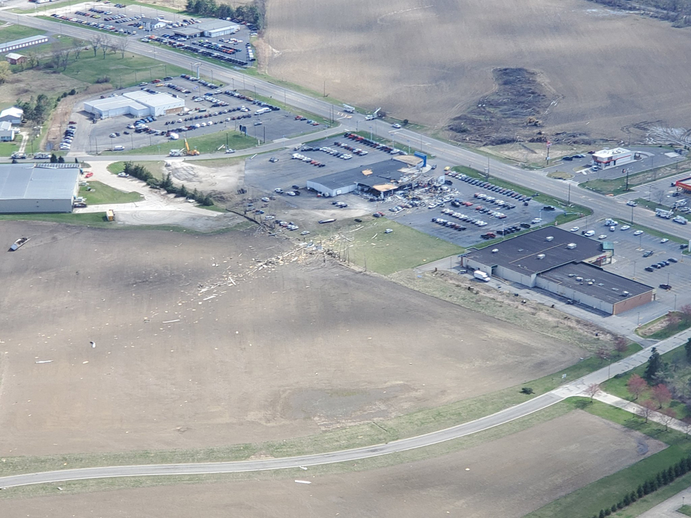
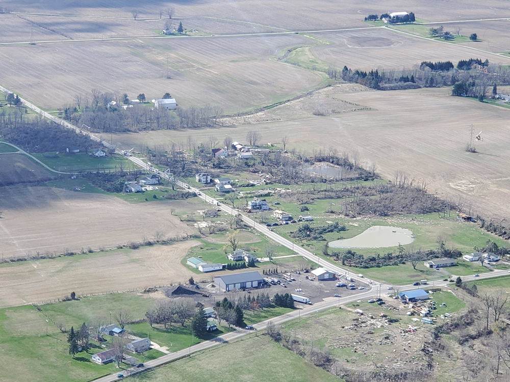
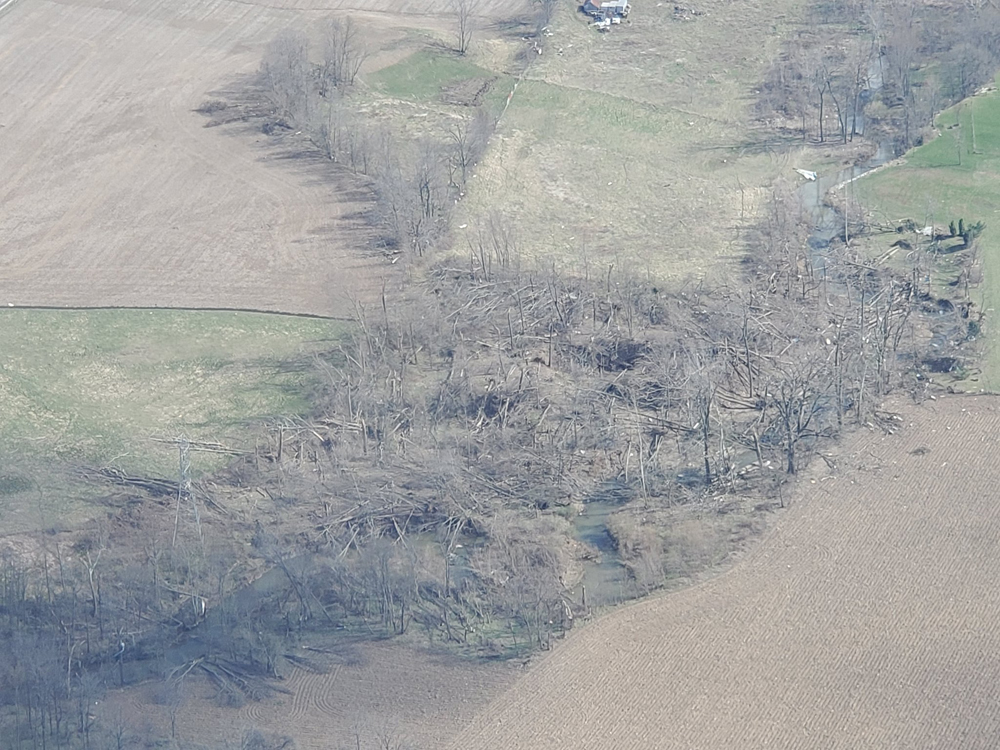
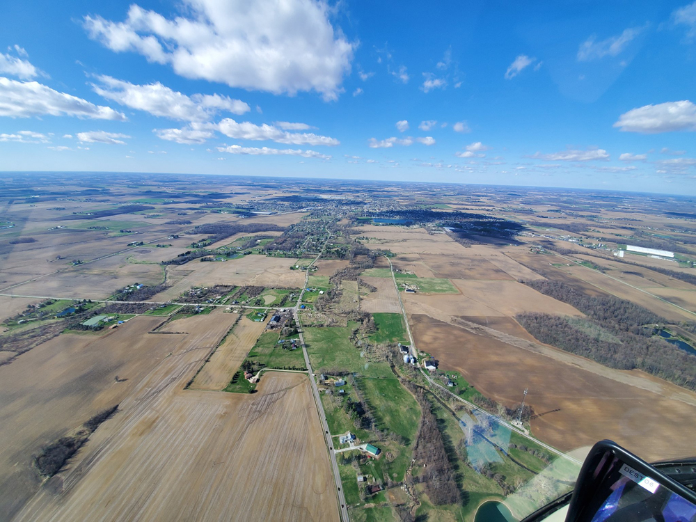
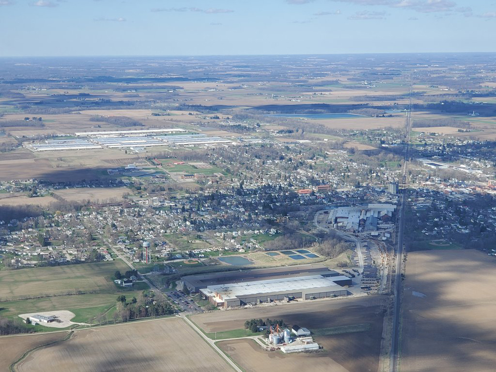
Photographs & images from the 2019 Shelby, Ohio Tornado. all media used with full permission.
Storm Events Database – National Weather Service Cleveland, Ohio
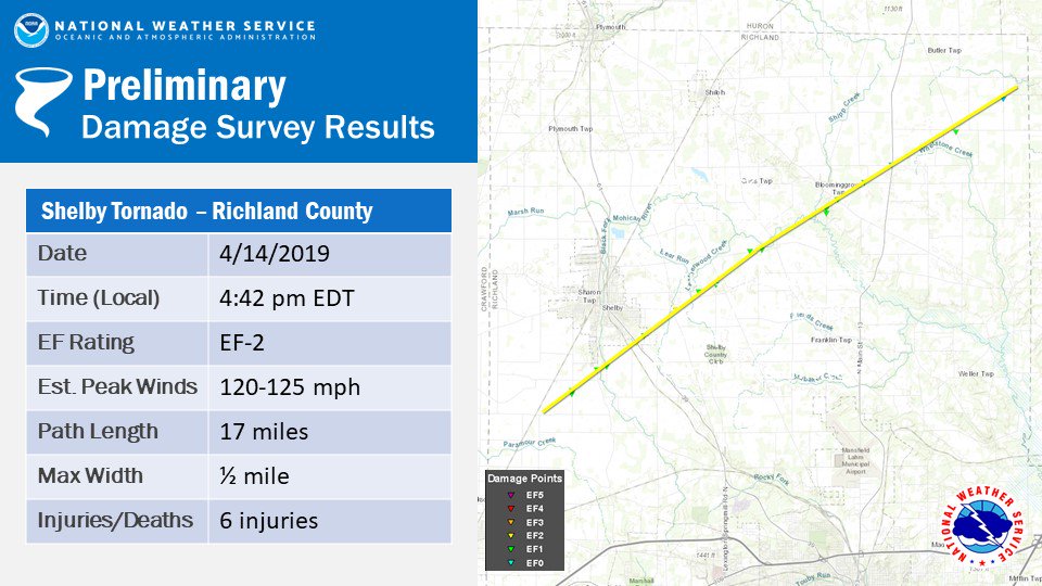
Event Details: Shelby, Ohio Tornado April 14th, 2019
| Event | Tornado |
| — Scale | EF2 |
| — Length | 17 Miles |
| — Width | 800 Yards |
| State | OHIO |
| County/Area | RICHLAND |
| WFO | CLE |
| Report Source | NWS Storm Survey |
| NCEI Data Source | CSV |
| Begin Date | 2019-04-14 15:42 EST-5 |
| Begin Location | 1.09SW VERNON JCT |
| Begin Lat/Lon | 40.8388/-82.6946 |
| End Date | 2019-04-14 16:00 EST-5 |
| End Location | 3.17NNE ADARIO |
| End Lat/Lon | 40.9713/-82.4237 |
| Deaths Direct/Indirect | 0/0 (fatality details below, when available…) |
| Injuries Direct/Indirect | 5/0 |
| Property Damage | 500.00K |
| Crop Damage | 0.00K |
| Episode Narrative | A warm front lifted northward across the region during the afternoon of April 14th. A strong area of low pressure moved from southwest Ohio through north central Ohio during the afternoon. The atmosphere quickly became unstable with plenty of shear and modest instability for severe storms including supercells. A tornado watch was in effect for most of northern Ohio. A strong tornado touched down across Richland County and hit the town of Shelby. |
| Event Narrative | A long track tornado began about 3 miles southwest of Shelby around 442 PM then tracked northeast to about 5 miles north of Olivesburg. EF 1 damage was seen along much of its 17 mile track. The most significant damage was located on the southeast and east side of Shelby from near the Chevy Dealership along State Route 39 northeastward to State Route 96 where a home was significantly damaged. This is where the EF 2 damage was observed and the tornado reached its maximum width of 1/2 mile. One vehicle was tossed 100 feet into the air with 2 people inside. The vehicle rolled multiple times before coming to a stop. Both persons inside the vehicle were luckily unharmed. |
Event Map:
Note: The tornado track is approximate based on the beginning (B) and ending (E) locations. The actual tornado path may differ from a straight line.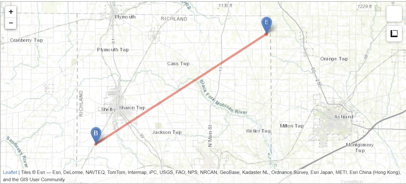
Leaflet | Tiles © Esri — Esri, DeLorme, NAVTEQ, TomTom, Intermap, iPC, USGS, FAO, NPS, NRCAN, GeoBase, Kadaster NL, Ordnance Survey, Esri Japan, METI, Esri China (Hong Kong), and the GIS User Community
All events for this episode:
| Location | County/Zone | St. | Date | Time | T.Z. | Type | Mag | Dth | Inj | PrD | CrD |
|---|---|---|---|---|---|---|---|---|---|---|---|
| Totals: | 0 | 5 | 598.00K | 0.00K | |||||||
| MARION ARPT | MARION CO. | OH | 04/14/2019 | 15:20 | EST-5 | Hail | 0.88 in. | 0 | 0 | 0.00K | 0.00K |
| PORT BUCYRUS ARPT | CRAWFORD CO. | OH | 04/14/2019 | 15:20 | EST-5 | Thunderstorm Wind | 52 kts. EG | 0 | 0 | 0.00K | 0.00K |
| VERNON JCT | RICHLAND CO. | OH | 04/14/2019 | 15:42 | EST-5 | Tornado | EF2 | 0 | 5 | 500.00K | 0.00K |
| VERNON JCT | RICHLAND CO. | OH | 04/14/2019 | 15:45 | EST-5 | Thunderstorm Wind | 52 kts. EG | 0 | 0 | 0.00K | 0.00K |
| SHILOH | RICHLAND CO. | OH | 04/14/2019 | 15:53 | EST-5 | Hail | 1.00 in. | 0 | 0 | 0.00K | 0.00K |
| APPLE CREEK | WAYNE CO. | OH | 04/14/2019 | 16:01 | EST-5 | Thunderstorm Wind | 52 kts. EG | 0 | 0 | 2.00K | 0.00K |
| APPLE CREEK | WAYNE CO. | OH | 04/14/2019 | 16:02 | EST-5 | Thunderstorm Wind | 52 kts. EG | 0 | 0 | 0.00K | 0.00K |
| SAVANNAH | ASHLAND CO. | OH | 04/14/2019 | 16:05 | EST-5 | Thunderstorm Wind | 56 kts. EG | 0 | 0 | 0.00K | 0.00K |
| CANAL FULTON | STARK CO. | OH | 04/14/2019 | 16:10 | EST-5 | Thunderstorm Wind | 56 kts. EG | 0 | 0 | 0.00K | 0.00K |
| BARBERTON | SUMMIT CO. | OH | 04/14/2019 | 16:15 | EST-5 | Thunderstorm Wind | 52 kts. EG | 0 | 0 | 1.00K | 0.00K |
| CANAL FULTON | STARK CO. | OH | 04/14/2019 | 16:15 | EST-5 | Tornado | EF0 | 0 | 0 | 50.00K | 0.00K |
| COMET | SUMMIT CO. | OH | 04/14/2019 | 16:17 | EST-5 | Tornado | EF0 | 0 | 0 | 10.00K | 0.00K |
| AKRON MAYFIELD ARPT | SUMMIT CO. | OH | 04/14/2019 | 16:26 | EST-5 | Thunderstorm Wind | 61 kts. EG | 0 | 0 | 0.00K | 0.00K |
| ELLET | SUMMIT CO. | OH | 04/14/2019 | 16:28 | EST-5 | Thunderstorm Wind | 52 kts. EG | 0 | 0 | 0.00K | 0.00K |
| MC DONALDSVILLE | STARK CO. | OH | 04/14/2019 | 16:29 | EST-5 | Thunderstorm Wind | 52 kts. EG | 0 | 0 | 5.00K | 0.00K |
| MOGADORE | SUMMIT CO. | OH | 04/14/2019 | 16:30 | EST-5 | Thunderstorm Wind | 52 kts. EG | 0 | 0 | 0.00K | 0.00K |
| RAVENNA | PORTAGE CO. | OH | 04/14/2019 | 16:45 | EST-5 | Hail | 1.00 in. | 0 | 0 | 0.00K | 0.00K |
| BRADY LAKE | PORTAGE CO. | OH | 04/14/2019 | 16:59 | EST-5 | Thunderstorm Wind | 52 kts. EG | 0 | 0 | 2.00K | 0.00K |
| PHALANX | TRUMBULL CO. | OH | 04/14/2019 | 17:07 | EST-5 | Thunderstorm Wind | 52 kts. EG | 0 | 0 | 1.00K | 0.00K |
| GUSTAVUS | TRUMBULL CO. | OH | 04/14/2019 | 17:18 | EST-5 | Thunderstorm Wind | 52 kts. EG | 0 | 0 | 0.00K | 0.00K |
| DAMASCUS | MAHONING CO. | OH | 04/14/2019 | 17:25 | EST-5 | Thunderstorm Wind | 56 kts. EG | 0 | 0 | 2.00K | 0.00K |
| CHURCHILL | TRUMBULL CO. | OH | 04/14/2019 | 17:37 | EST-5 | Thunderstorm Wind | 52 kts. EG | 0 | 0 | 5.00K | 0.00K |
| GIRARD | TRUMBULL CO. | OH | 04/14/2019 | 17:38 | EST-5 | Thunderstorm Wind | 52 kts. EG | 0 | 0 | 1.00K | 0.00K |
| WASHINGTONVILLE | MAHONING CO. | OH | 04/14/2019 | 17:38 | EST-5 | Thunderstorm Wind | 52 kts. EG | 0 | 0 | 2.00K | 0.00K |
| ERIESIDE | LAKE CO. | OH | 04/14/2019 | 17:39 | EST-5 | Thunderstorm Wind | 52 kts. EG | 0 | 0 | 5.00K | 0.00K |
| HOWLAND CORNERS | TRUMBULL CO. | OH | 04/14/2019 | 17:40 | EST-5 | Thunderstorm Wind | 52 kts. EG | 0 | 0 | 0.00K | 0.00K |
| CORNERSBURG | MAHONING CO. | OH | 04/14/2019 | 17:45 | EST-5 | Thunderstorm Wind | 52 kts. EG | 0 | 0 | 2.00K | 0.00K |
| ORANGEVILLE | TRUMBULL CO. | OH | 04/14/2019 | 17:48 | EST-5 | Thunderstorm Wind | 52 kts. EG | 0 | 0 | 0.00K | 0.00K |
| STRUTHERS | MAHONING CO. | OH | 04/14/2019 | 17:49 | EST-5 | Thunderstorm Wind | 52 kts. EG | 0 | 0 | 5.00K | 0.00K |
| HUBBARD | TRUMBULL CO. | OH | 04/14/2019 | 17:50 | EST-5 | Thunderstorm Wind | 52 kts. EG | 0 | 0 | 0.00K | 0.00K |
| MARTINSBURG | KNOX CO. | OH | 04/14/2019 | 17:58 | EST-5 | Thunderstorm Wind | 52 kts. EG | 0 | 0 | 0.00K | 0.00K |
| HOWARD | KNOX CO. | OH | 04/14/2019 | 18:03 | EST-5 | Thunderstorm Wind | 52 kts. EG | 0 | 0 | 5.00K | 0.00K |
| Totals: | 0 | 5 | 598.00K | 0.00K |
Photographs & images from the 2019 Shelby, Ohio Tornado. all media used with full permission.


Video from the 2019 Shelby, Ohio Tornado. all media used with full permission.