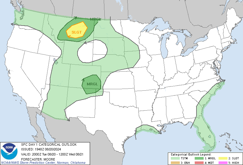
SPC May 4, 2024 0100 UTC Day 1 Convective Outlook
2024-05-04
SPC 0100Z Day 1 Outlook


Day 1 Convective Outlook
NWS Storm Prediction Center Norman OK
0752 PM CDT Fri May 03 2024

Valid 040100Z - 041200Z

...THERE IS A SLIGHT RISK OF SEVERE THUNDERSTORMS ACROSS PORTIONS OF
THE CENTRAL AND SOUTHERN PLAINS...

...SUMMARY...
Scattered severe thunderstorms are expected across portions of the
central and southern Plains. Large hail and damaging winds are the
primary risks.

...01z Outlook...

Cool mid-level profiles, and steep lapse rates contributed to the
evolution of supercell clusters over much of northwest TX into the
Edwards Plateau region. This activity is beginning to overturn much
of the buoyancy across northwest TX, hence the strongest updrafts
are now propagating southeast across the Edwards Plateau along an
instability axis characterized by MLCAPE on the order of 3000 J/kg.
Additionally, strong convection has developed just west of the
international border and is approaching Eagle Pass. Will adjust
severe probabilities into the middle Rio Grande Valley to account
for this activity spreading east of the River.

Farther north, organized band of thunderstorms has developed along a
cold front that is surging southeast across south-central
NE-northwest KS-northeast CO. In addition to a few dryline
supercells over western KS, this complex will continue to propagate
southeast aided in large part to the surging cold front. Given the
organization of this activity, and momentum, will extend higher
severe probs a bit downstream to account for wind/hail threat with
this squall line.

..Darrow.. 05/04/2024
SPC MD 624
2024-05-03
SPC Mesoscale Discussions
MD 0624 CONCERNING SEVERE THUNDERSTORM WATCH 179… FOR PORTIONS OF THE EDWARDS PLATEAU OF TEXAS
Mesoscale Discussion 0624
NWS Storm Prediction Center Norman OK
0938 PM CDT Fri May 03 2024

Areas affected...portions of the Edwards Plateau of Texas

Concerning...Severe Thunderstorm Watch 179...

Valid 040238Z - 040445Z

The severe weather threat for Severe Thunderstorm Watch 179
continues.

SUMMARY...Local severe risk may continue for another 1 to 2 hours.
While a local extension of the WW in time may be needed locally, new
WW issuance is not expected.

DISCUSSION...Latest radar loop shows storms gradually diminishing in
general across the region, in and near WW 179.  The strongest storms
are ongoing now over the Kimble county vicinity, where large hail is
indicated per recent WSR-88D data.

While an overall decrease in storms should continue, and is
supported by various CAMs, the Kimble county convection may continue
for the next hour or two, shifting slowly
southward/south-southeastward with time.  Severe risk in this area
appears sufficient to warrant a local extension of WW 179 beyond its
scheduled 04/03Z expiration.

..Goss.. 05/04/2024

...Please see www.spc.noaa.gov for graphic product...

ATTN...WFO...EWX...SJT...

LAT...LON   29700017 30740041 30899982 30739938 30329924 29939919
            29700017
https://www.spc.noaa.gov/products/md/md0624.htmlSPC Mesoscale Discussions
SPC MD 623
2024-05-03
SPC Mesoscale Discussions
MD 0623 CONCERNING SEVERE POTENTIAL…SEVERE THUNDERSTORM WATCH LIKELY FOR PORTIONS OF NORTHWEST OKLAHOMA…CENTRAL KANSAS…SOUTHEAST NEBRASKA
Mesoscale Discussion 0623
NWS Storm Prediction Center Norman OK
0926 PM CDT Fri May 03 2024

Areas affected...Portions of northwest Oklahoma...central
Kansas...southeast Nebraska

Concerning...Severe potential...Severe Thunderstorm Watch likely

Valid 040226Z - 040430Z

Probability of Watch Issuance...80 percent

SUMMARY...The environment should remain supportive of large hail and
severe wind gusts over the next few hours. A low-end tornado threat
will also exist, particularly for remaining discrete storms. A new
severe thunderstorm watch is likely.

DISCUSSION...Convection within the central/southern Plains continues
to move eastward this evening. Regional VAD wind show and increase
in the low-level jet (40-50 kts). Along with the low-level jet, 60+
F dewpoints and observed steep mid-level lapse rates will continue
to support some threat for large hail and severe wind gusts.
Low-level hodograph curvature is evident on VAD wind profiles as
well. Some tornado threat will exist, though the primarily linear
storm mode should limit a greater threat. A new severe thunderstorm
watch will likely be needed for at least parts of areas from
northwest Oklahoma into southeast Nebraska.

..Wendt/Guyer.. 05/04/2024

...Please see www.spc.noaa.gov for graphic product...

ATTN...WFO...OAX...TOP...ICT...OUN...GID...DDC...AMA...

LAT...LON   39759800 40359737 40629696 40469657 39489649 38579701
            37399791 35949880 35549936 35419993 36060004 37129925
            38239881 39759800
https://www.spc.noaa.gov/products/md/md0623.htmlSPC Mesoscale Discussions
Overcast and 69 F at Dayton / Wright-Patterson Air Force Base, OH
2024-05-03

Winds are Calm. The pressure is 1015.4 mb and the humidity is 87%.
Last Updated on May 3 2024, 8:55 pm EDT.
Winds are Calm. The pressure is 1015.4 mb and the humidity is 87%.
Last Updated on May 3 2024, 8:55 pm EDT.
Last Updated on May 3 2024, 8:55 pm EDT.
SPC MD 622
2024-05-03
SPC Mesoscale Discussions
MD 0622 CONCERNING SEVERE THUNDERSTORM WATCH 180… FOR SOUTHWEST KANSAS INTO NORTHWEST KANSAS
Mesoscale Discussion 0622
NWS Storm Prediction Center Norman OK
0828 PM CDT Fri May 03 2024

Areas affected...Southwest Kansas into northwest Kansas

Concerning...Severe Thunderstorm Watch 180...

Valid 040128Z - 040330Z

The severe weather threat for Severe Thunderstorm Watch 180
continues.

SUMMARY...Large hail and severe wind gusts remain possible even as
storms may tend to become elevated later into the evening.

DISCUSSION...KVNX/KDDC VAD profiles show an increase in the
low-level jet. The 00Z observed DDC sounding showed very steep
mid-level lapse rates though some capping was also present. Current
convection in WW 180 is expected to continue eastward with aid from
the low-level jet. The primary severe risk will exist with a storm
near the Wichita/Kearney County line. This storm will be capable of
hail up to 1.5-2 in. A line of storms is also moving east from near
Garden City to just west of Beaver, OK. This line has shown some
deepening cores on MRMS CAPPI and could produce severe wind gusts.
The overall eastern extent of the severe risk is not clear. However,
even as storms may become elevated with time, large hail and
isolated damaging winds could still occur. The tornado risk is
conditional on a discrete storm mode and should continue to diminish
as low-level stability increases. Some areal extension of WW 180
could be needed depending on convective trends over the next 2
hours.

..Wendt.. 05/04/2024

...Please see www.spc.noaa.gov for graphic product...

ATTN...WFO...ICT...OUN...DDC...GLD...AMA...

LAT...LON   38680144 39000081 38999910 38689893 38069879 38049879
            37999879 37279897 36849950 36660018 36540079 36620141
            36700160 38680144
https://www.spc.noaa.gov/products/md/md0622.htmlSPC Mesoscale Discussions
SPC Day 3-8 Fire Weather Outlook
2024-05-03

SPC Day 3-8 Fire Weather Outlook
Day 3-8 Fire Weather Outlook
NWS Storm Prediction Center Norman OK
0401 PM CDT Fri May 03 2024

Valid 051200Z - 111200Z

An active period of fire weather concerns remains likely beginning
late this weekend and lasting well into the upcoming work week. The
greatest fire weather risk will be focused across the central to
southern Rockies and into adjacent areas of the central/southern
High Plains where a dry air mass is already in place. Latest
ensemble guidance continues to show strong agreement in the
evolution of an upper-level trough (currently noted in water-vapor
imagery over the northeast Pacific) as it translates east across the
inter-mountain West and into the Plains Sunday and Monday, reaching
the Great Lakes/northern Plains by Tuesday/Wednesday. Strong low to
mid-level flow associated with this system will support multiple
days of dry, windy conditions with an accompanying fire weather
risk.

...D3/Sunday to D6/Wednesday - New Mexico and adjacent portions of
TX/CO...
Strong divergence aloft ahead of the approaching upper-level wave
will support broad surface pressure falls across the central Rockies
on Sunday afternoon. In response, southerly winds will increase
across much of the Four Corners region into central and eastern NM.
Latest mid-range ensemble guidance suggests sustained 20-25 mph
winds will be common by late afternoon when RH values should be
reaching their diurnal minimums between 10-20%. Although fuels
across western NM are not overly dry as of Friday afternoon,
dry/windy conditions on Saturday across this region should help cure
finer fuels by Sunday.

Perhaps the most intense fire weather conditions are anticipated on
Monday afternoon across portions of east/northeast NM. The ejection
of the surface low into the Plains Monday afternoon will support
strong westerly downslope winds off the central/southern Rockies.
This will maintain dry conditions across the region with 10-20% RH
common. Elevated conditions are expected across a broad swath of the
High Plains with critical conditions likely across much of eastern
NM. Latest forecast guidance hints that 25-30 mph sustained winds
are probable across northeast NM in the lee of the Sangre de Cristo
Mountains. While this portion of northeast NM is currently receiving
rainfall, such dry/windy conditions should yield dried grasses after
a few hours.

Persistent zonal flow will linger over the southern Rockies
D5/Tuesday into D6/Wednesday. This will maintain a downslope flow
regime with an attendant dry air mass (afternoon minimum RH values
in the teens) across the southern High Plains with potential both
days for elevated to critical fire weather conditions. The critical
risk areas have been adjusted in this outlook update to reflect
where medium to long-range ensemble guidance shows the strongest
signal for sustained 20+ mph winds. These areas will likely be
refined in subsequent outlooks as mesoscale details come into focus.
Elevated conditions may linger into D7/Thursday across southern NM,
but weakening gradient winds aloft should limit fire weather
potential compared to previous days.

..Moore.. 05/03/2024

...Please see www.spc.noaa.gov/fire for graphic product...


