Skip to content
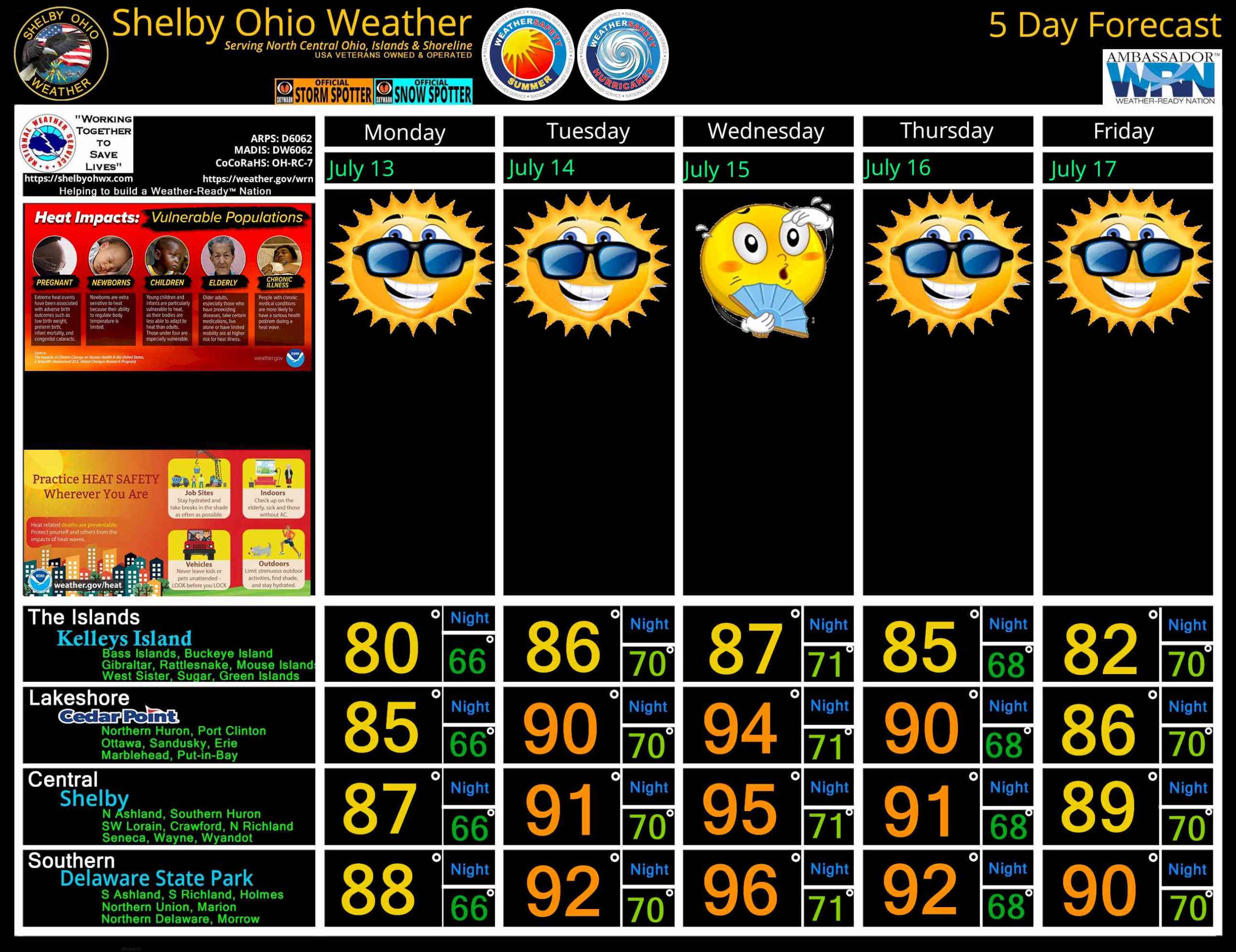
North Central Ohio 5 Day forecast for July 13 – 17, 2026
July 12, 2026
by
ShelbyOhWx
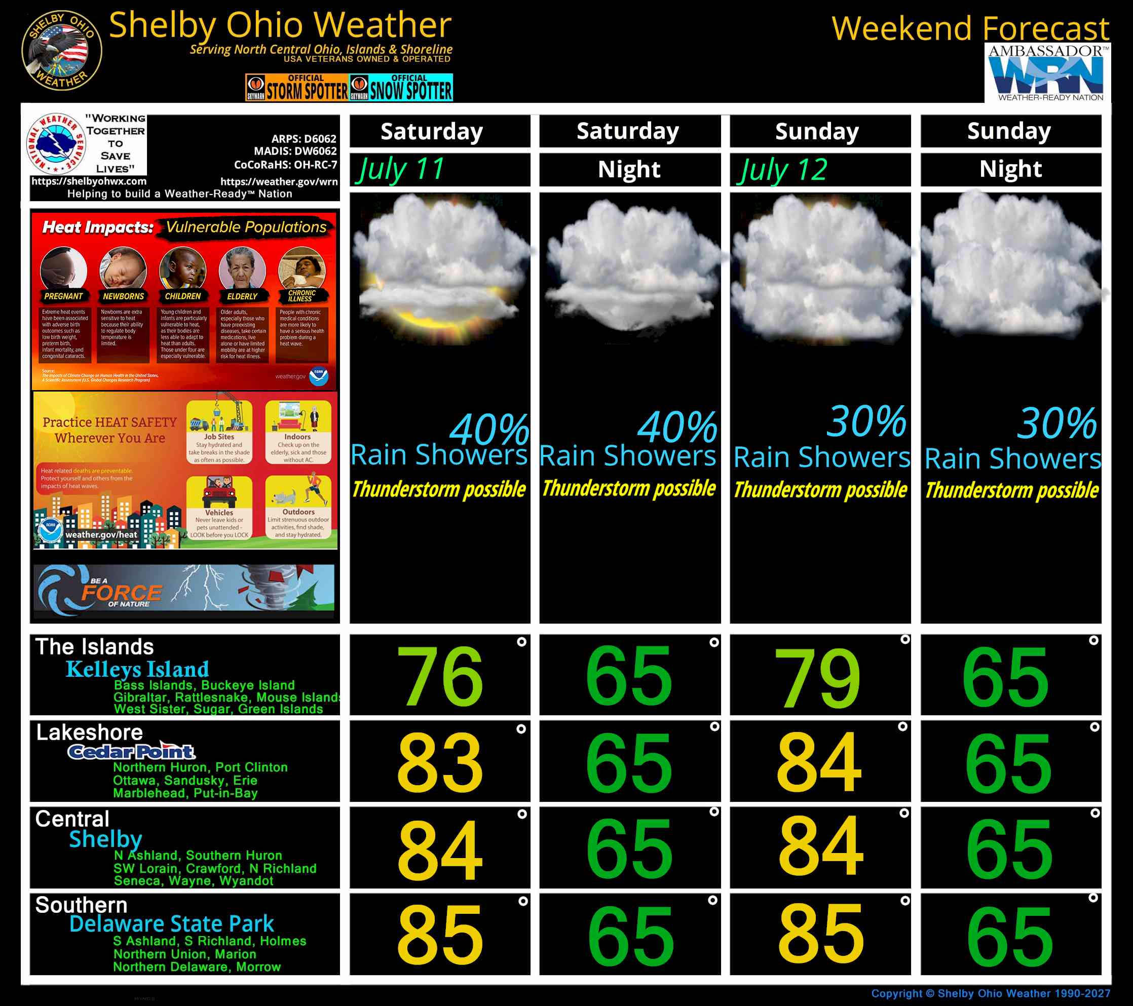
North Central Ohio Weekend forecast for July 11-12, 2026
July 11, 2026
by
ShelbyOhWx
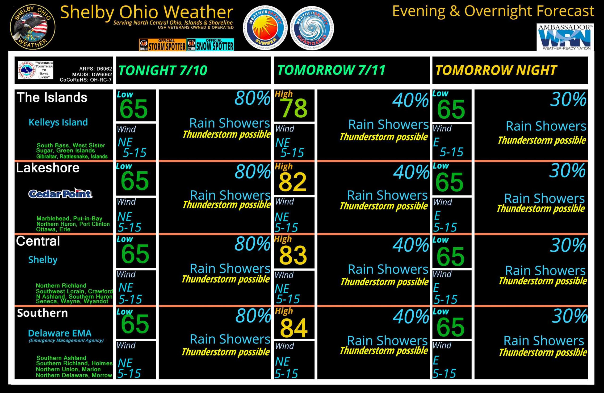
North Central Ohio Overnight forecast July 10-11, 2026
July 10, 2026
by
ShelbyOhWx
Newer posts
←
Previous
Page
1
…
Page
69
Page
70
 Skip to content