Derecho development
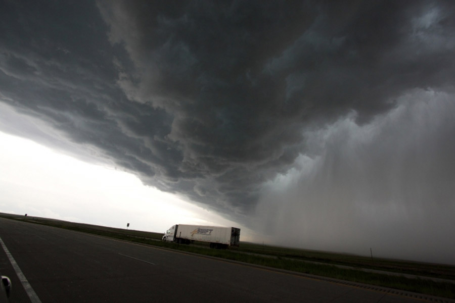
Derecho development necessarily is tied to the formation of bow echoes. A bow echo usually arises from a cluster of thunderstorms, but also may evolve from a single strong storm. Bow echoes most frequently occur when tropospheric winds are relatively strong and unidirectional (i.e., they vary little in direction with height). As the rain-cooled downdraft of a thunderstorm reaches the earth’s surface, it spreads horizontally, most rapidly in the direction of the mean tropospheric flow. As the cool, dense air spreads outward, it forces the lighter, warm and moist air surrounding the storm up along the leading edge of the outflow, or gust front (see figure below, with mean flow assumed to be from left to right). The upward motion along the gust front typically is greatest along that part of the front that is moving most rapidly — that is, progressing — in the downwind direction (to the right in the figure). Gust fronts often are marked by low, ominous cloud formations known as arcus or shelf clouds.
The development of a thunderstorm’s downdraft ordinarily marks the dissipation stage of that particular storm. But air forced up along a gust front can give birth to new thunderstorms. As new storms mature, the rain they produce reinforces the existing “pool” of rain-cooled air produced by earlier storms, allowing the gust front to maintain its strength. As this cold pool increases in size and elongates in the direction of the mean wind, it may induce an inflow of air known as the rear-inflow jet (dashed brown arrow in figure below) on the trailing side of the thunderstorm complex. This causes the updraft to tilt toward the rear side of the storm (i.e., to the left in the figure). Tilting of the updraft allows the thunderstorm to further expand, increasing the aerial coverage of the rain. This, in turn, adds to the pool of cold air accumulating beneath the storm and strengthens the gust front, causing it to bow outward in the downwind direction. The resulting acceleration in forward motion of the gust front subsequently forces more warm, moist air upward, creating still more storms, and the process repeats.
The rain produced by the newer storms reinforces the cold pool, strengthening the inflow of air from the back side of the developing storm complex and encouraging the downward transport of higher momentum air from aloft. These processes can enable the system to attain a nearly steady-state condition. At this point, the convective system typically exhibits a pronounced bow shape on radar (see figure below) and satellite, with an area of moderate to occasionally heavy rain located near the center of the cold pool, well behind the arc of intense rain immediately behind the gust front. As long as the thermodynamic and kinematic environments support the continued development of new thunderstorm cells in the downwind direction along the advancing gust front — a process known as downwind or “forward” propagation — the convective complex will persist, along with the potential for downbursts and microbursts.
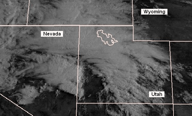
An animated, (below) visible data satellite view of a derecho-producing convective system appears below. This particular event (May 31, 1994) occurred in a relatively dry environment over Utah and western Wyoming. Because of this, there was minimal supplementary cloud cover that tends to obscure the active storm towers of systems occurring in more moist regimes. As a result, the case well-illustrates the process of forward propagation along a convective system gust front. As the arc-shaped gust front advances from southwest to northeast across Utah, the rapidly-growing, new updrafts appear as sharply-outlined whitish clumps (cumulus and cumulonimbus clouds). These stand in marked contrast to the more fibrous debris clouds (cirrus “anvils”) that are left behind as the gust front continues northeastward, undercutting the older updrafts and severing their link to warm, buoyant air. The derecho-producing convective system is therefore seen to be composed of a series of discrete, downwind-developing, wind-producing thunderstorms. More on thunderstorm propagation and the impact of propagation on the predominant storm hazards posed follows in the next section.