Overnight and Tomorrows forecast 5- 9/10
Tonight – 40% Showers and T-storms. Low 47°F. Wind N, 5 to 15 mph.
Tomorrow 5/10 – 20% Showers before 10am, High 59°F. Wind N, 5 to 15 mph.
Tomorrow night – Overcast, Low 43°F. Wind N, 5 to 10 mph.
Tonight – 40% Showers and T-storms. Low 47°F. Wind N, 5 to 15 mph.
Tomorrow 5/10 – 20% Showers before 10am, High 59°F. Wind N, 5 to 15 mph.
Tomorrow night – Overcast, Low 43°F. Wind N, 5 to 10 mph.

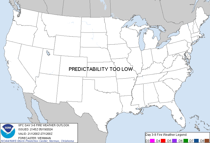
Day 3-8 Fire Weather Outlook
NWS Storm Prediction Center Norman OK
0251 PM CDT Thu May 09 2024

Valid 111200Z - 171200Z

Fire weather concerns appear limited through the extended period,
though localized concerns may emerge across portions of the
Southwest amid persistent warm/dry conditions. Long-range ensemble
guidance shows reasonably good agreement in the evolution of the
overall synoptic regime through the beginning of the upcoming work
week. Mean longwave troughing should persist across the central to
western CONUS with embedded perturbations propagating across the
Southwest into the Plains. This will support intermittent rain
chances along and east of the Rockies through early next week, which
should limit fuel dryness. Ensemble consensus suggests that portions
of southern AZ/southwest NM will see low probability for wetting
rainfall through the extended period, which should aid in curing
already modestly dry fuels. Multiple days of elevated fire weather
conditions appear probable through the upcoming weekend and into
early next week based on both deterministic and ensemble solutions.
Fire concerns appear most likely on D3/Saturday and D4/Sunday across
southwest NM and far southeast AZ, but the probability of reaching
critical wind thresholds appears too limited to warrant risk
probabilities at this time. The potential for elevated conditions
will continue into the middle portions of next week over the
Southwest/Four Corners region, but the weak/low-amplitude nature of
the upper-level waves combined with notable spread in guidance
pertaining to mesoscale details suggests low predictability beyond
this weekend.

..Moore.. 05/09/2024

...Please see www.spc.noaa.gov/fire for graphic product...

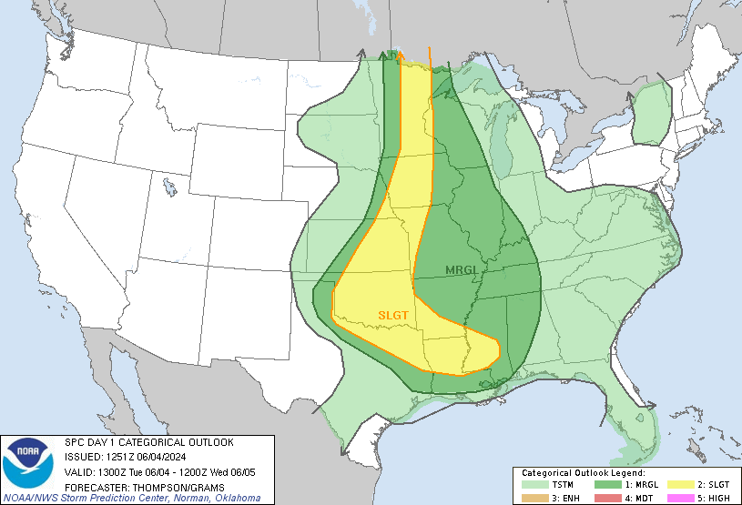
Day 1 Convective Outlook
NWS Storm Prediction Center Norman OK
0804 PM CDT Thu May 09 2024

Valid 100100Z - 101200Z

...THERE IS AN ENHANCED RISK OF SEVERE THUNDERSTORMS FROM
CENTRAL/EAST TX ACROSS PARTS OF THE SOUTHEAST...

...SUMMARY...
Ongoing supercells will continue to pose a very large hail threat
across central and east Texas this evening, with other severe storms
across parts of the Southeast. A corridor of potentially significant
damaging wind remains possible late tonight across east Texas,
Louisiana, southern parts of Mississippi, Alabama, and Georgia, and
perhaps into north Florida.

...Texas into parts of the Southeast...
Intense supercells are ongoing this evening across parts of central
TX, within an extremely unstable and favorably sheared environment.
Very large hail will continue to be a threat for as long as the
supercell structures persist this evening, along with severe gusts
and possibly a tornado or two. Farther east, convection is gradually
increasing in coverage across parts of central MS/AL, near/south of
an outflow boundary. A very moist/unstable environment and strong
deep-layer shear will support potential for a few supercells through
the evening, with a threat of large hail (possibly very large),
localized severe gusts, and possibly a tornado.

With very favorable moisture and instability in place from east
Texas across the Southeast and moderate unidirectional flow aloft,
potential remains for an upscale-growing storm cluster to evolve
into a fast-moving MCS, which could produce a swath of damaging
winds late tonight across the Southeast. Considerable uncertainty
remains, however, regarding storm evolution through the evening,
with potential for extensive convection across MS/AL as a cold front
moves southward across the region. This convection would pose a
severe threat, but would also tend to push the outflow southward
with time.

If an eastward-moving cluster can evolve across TX or LA and become
favorably aligned with the effective surface boundary, then an
organized bow could surge eastward with widespread damaging wind. It
is also possible that one or more clusters could evolve out of the
MS/AL convection. Regardless of evolution, widespread convection is
expected across much of the Southeast through the night within a
favorable environment, with one or more corridors of damaging wind
possible, along with a threat of hail and possibly a tornado or two.

..Dean.. 05/10/2024


LEZ144 The Islands to Vermilion OH* WHAT…Northeast winds 15 to 20 knots and waves 2 to 4 feet.
* WHERE…The nearshore waters of Lake Erie from the Islands OH
to Ripley NY.
* WHEN…Until 7 AM EDT Friday.
* IMPACTS…Conditions will be hazardous to small craft.https://api.weather.gov/alerts/urn:oid:2.49.0.1.840.0.43291b58ebe4710a13c8daf4f4e547861a828cae.002.1.cap9:33 pmMay 9, 2024
LEZ143 Reno Beach to The Islands OH* WHAT…Northeast winds around 15 to 20 knots and waves 2 to 4
feet.
* WHERE…The nearshore waters of Lake Erie from Maumee Bay to
The Islands OH.
* WHEN…Until 4 AM EDT Friday.
* IMPACTS…Conditions will be hazardous to small craft.https://api.weather.gov/alerts/urn:oid:2.49.0.1.840.0.43291b58ebe4710a13c8daf4f4e547861a828cae.001.1.cap9:32 pmMay 9, 2024